Palace
Château de Villiers-le-Bâcle
 France · 18th century
- Founded
- c. 1750
- Style
- Louis XIII style
- Heritage status
- monument historique inscrit · listed in the general inventory of cultural heritage
- Location
- Villiers-le-Bâcle
- Coordinates
- 48.724°, 2.12839°
- Open data
- Wikidata Q2971025
- Links
- Wikimedia Commons
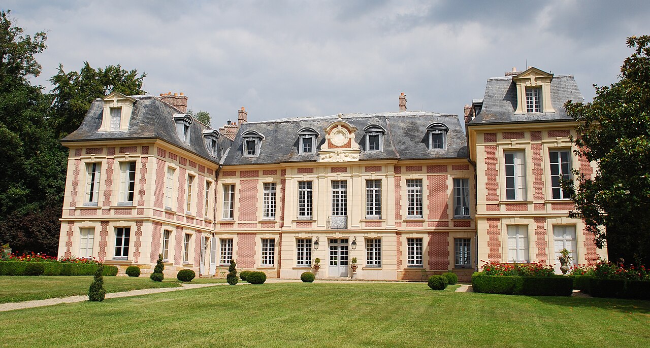
Description
The Château de Villiers-le-Bâcle is a French château located in the commune of Villiers-le-Bâcle, in the department of Essonne and the Île-de-France region, twenty-two kilometres south-west of Paris.
Dating from the 18th century, it is surrounded by a park of 40 ha. It was partially registered as a historic monument in 1946.
Machine-translated from “Château de Villiers-le-Bâcle” on the French Wikipedia, CC BY-SA 4.0.
In the rankings
Château de Villiers-le-Bâcle ranks #6,655 of 9,902 worldwide in the atlas's castle fame ranking, and #601 of the 954 mapped in France. Founded c. 1750, it is older than 17% of the atlas's dated landmarks, one of 757 atlas entries founded in the 18th century. Its Wikipedia articles were opened 1,250 times in the last 60 days, more than 62% of the atlas. 56 more atlas landmarks stand within 25 km. The nearest day-trip guide is Paris, 22 km away. See how France compares in the castle statistics.
Castles nearby
- Château de Vaugien4 km · France
- Château des Roches6 km · France
- Château de la Madeleine7 km · France
- Palace of Versailles9 km · France
More castles in France
- Château de MontmirailFrance
- Château de CastelmoreFrance
- Château de la ChasseFrance
- Château de l'IsletteFrance · 16th century