The atlas
About the Castle Map
A free interactive night map of the world's great castles, fortresses, palaces and ruins: 9,035 landmarks across 155 countries, each with its photo and story. No account needed.
How it is made
Everything on this map comes from open data: facts, coordinates and founding dates from Wikidata, photographs from Wikimedia Commons, stories from Wikipedia, and the night basemap from OpenFreeMap and Natural Earth. The atlas is curated, not exhaustive: the 9,035 most significant landmarks worldwide, ordered by a fame ranking that blends Wikipedia coverage with real readership.
Missing a castle, or spotted a wrong date? The best route is improving its Wikidata entry: well-documented sites join the atlas at the next refresh, and the correction helps everyone else who uses the same open data.
What counts as a castle
No single definition satisfies everyone: a Burg, a château, a star fort and a Mughal palace are not the same kind of building, and every country draws the line differently. Rather than adopt one national definition, the atlas sorts each landmark into four plain categories, and this is the rule it uses.
Castle & château, a fortified residence: someone lived there, and it was built to be held. Fortress & fort, built for a garrison rather than a household: citadels, star forts, coastal batteries. Palace & residence: a grand residence with no serious defensive purpose. Ruin is not a fourth kind of building but a state: any of the other three that no longer stands as it was, including sites that have vanished completely, which is why the Bastille and Fort Duquesne are filed as ruins even though nothing of either remains above ground.
The classification is mechanical, in this order. A Wikipedia lead that describes remains or an unrepaired destruction makes it a ruin. Otherwise an unambiguous word in the landmark’s own name wins: “Kufstein Fortress” is a fortress whatever Wikidata types it. Otherwise Wikidata’s own type decides, then the English description. Genuinely ambiguous words stay ambiguous: château and Schloss mean castle in one valley and palace in the next, and here they lean palace.
Inclusion is a separate question from classification. A landmark needs a real photograph, exact coordinates and a Wikipedia article (in English or any of the 26 other editions the atlas reads) plus enough Wikipedia editions to show it is documented rather than merely listed. That bar is why this is a curated 9,035 and not the hundreds of thousands of fortified structures that exist; France alone has tens of thousands. Falling below it is not a verdict on a castle’s importance, only on how well the open data describes it so far.
One route past that bar: a list drawn by a national authority on castles. Japan’s 100 Famous Castles and Continued 100 Famous Castles, chosen by the Japan Castle Foundation in 2006 and 2017, admit every landmark on them however few Wikipedia editions cover it, because a fame ranking built on Wikipedia is a poor judge of a country whose castles are written up in one language. The lists are read from Japanese Wikipedia’s own categories. Other countries with a comparable list can join them; tell us about one.
Who keeps it
The atlas is made by one person, under the pseudonym Mr. Flightmussy. Every user-visible change lands in the changelog (with an Atom feed). Contact: ceoflightmussy@gmail.com.
I am the creator of the website Movie Scene Map. First of all, I want to thank all and each of you wherever in the world you come from.
 Flightmussy Studio
A studio for interactive maps: Castle Map, Movie Scene Map, World Train Map and Sunshine Atlas.
studioflightmussy.com
Flightmussy Studio
A studio for interactive maps: Castle Map, Movie Scene Map, World Train Map and Sunshine Atlas.
studioflightmussy.com
More maps from the same creator
Movie Scene Map, World Train Map and Sunshine Atlas are made and run by Mr. Flightmussy, the creator of Castle Map, at Flightmussy Studio. The same method, on a different subject.
-
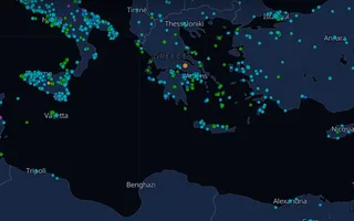
 Movie Scene Map
Filming locations of films and series worldwide
moviescenemap.com
Movie Scene Map
Filming locations of films and series worldwide
moviescenemap.com
-
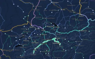
 World Train Map
Every notable passenger railway on earth
worldtrainmap.com
World Train Map
Every notable passenger railway on earth
worldtrainmap.com
-
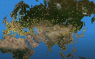
 Sunshine Atlas
Sunshine, temperature and sea, month by month, for destinations worldwide
sunshineatlas.com
Sunshine Atlas
Sunshine, temperature and sea, month by month, for destinations worldwide
sunshineatlas.com
Everything is open
The full dataset is free to download (GeoJSON and CSV, CC0, citable via DOI). The statistics page computes it through, an MCP server at thecastlemap.com/mcp answers live queries from AI assistants, and the map itself is free to embed.
Featured in
Independent write-ups, front pages and newsletters have carried the atlas since it launched. None of it was pitched or paid for.
Write-ups

























Front pages





Newsletters


The full list, with a link to every piece
Independent write-ups of the atlas have appeared in Yahoo, BILD, Le Figaro, Ouest-France, 20minutos, Euronews, The Verge, Xataka, Time Out, GIGAZINE, TRAVELBOOK, Computer Hoy, Delfi, Antena 3 CNN, Zerkalo, N1, Karapaia, Boing Boing, MetaFilter, Microsiervos, EN World, CHIP, Newsweek România, Jurnalul, Travel.gr, Focus, faktastisch, Hosteltur, Neatorama, Bright, Nasha Niva, TidyTuesday, Wikidata on Mastodon, Backyard Garden Lover, Go Fug Yourself, 34travel, Travel Tomorrow, Lelépő, Travel.com.br, Mallorca Hora, Kultmix, Sólo Arquitectura, Positivnews, ResearchBuzz, beSpacific, Gisplay, Elventure, ThinkTanks, Archivalia, Kastelen Magazine, Castles and Gardens of Europe, The European Circle, Realbrest, NewGrodno, Belnovosti, Komkur, Travel Between The Pages, Shevarezo, PCあれこれ探索, eay.cc, Ludovic Chabant, Dominik Holzer, Urban.ro, Playtech, cotidianulhd.ro, Tabu, szatmar.ro, Cruzamundos, DenkfabrikBlog, Travel Blogger Buzz, Pergelator, among others. It has also made the front pages of Hacker News, r/MapPorn, Wykop, Fark, Menéame, r/castles, Tildes, and travelled through newsletters like 1440, The Overflow (Stack Overflow), Wikidata Weekly Summary, Tangle, Hacker Newsletter, weeklyOSM, The Neutral, 1% Better, PAX (Artribune), Colorintech, Strong Sense of Place, The Arrow, Trappe Travel, Ràfagas (Geoinquiets), Stuff that MattRs, Mapas Milhaud, No tan random, Double Maths First Thing (The Aperiodical), ReHacked, Savantgarde, Hey Lauderdale, Just a Peck. None of it was pitched or paid for.
Logos from Wikimedia Commons where a free copy exists; the rest are set in type. The trademarks belong to their owners.