Fortress
Fort Gibson
🇺🇸 United States · 19th century
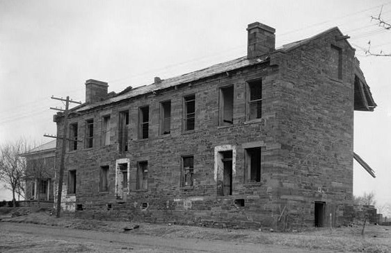
Fort Gibson is a historic military site next to the modern city of Fort Gibson, in Muskogee County Oklahoma. It guarded the American frontier in Indian Territory from 1824 to 1888. When it was constructed, the fort was farther west than any other military post in the United States. It formed part of the north–south chain of forts that was intended to maintain peace on the frontier of the American West and to protect the southwestern border of the Louisiana Purchase. The fort succeeded in its peacekeeping mission for more than 50 years, as no massacres or battles occurred there.
The site is now managed by the Oklahoma Historical Society as the Fort Gibson Historical Site and is a National Historic Landmark.
Text adapted from “Fort Gibson” on Wikipedia, CC BY-SA 4.0.
Fort Gibson ranks #4,354 of 8,134 worldwide in the atlas's castle fame ranking, and #82 of the 103 mapped in United States. Founded 1824, it is older than 11% of the atlas's dated landmarks — one of 607 atlas entries founded in the 19th century. Its Wikipedia articles were opened 1,330 times in the last 60 days, more than 56% of the atlas. See how United States compares in the castle statistics.
View on the interactive castle map →Frequently asked questions
Where is Fort Gibson?
Fort Gibson stands in the United States, at 35.8039°, -95.2572°.
When was Fort Gibson built?
The atlas dates its founding to 1824. Earlier structures may have stood on the site; this is the earliest documented founding year.
How famous is Fort Gibson?
In this atlas's fame ranking: #4,354 of 8,134 worldwide, and #82 in the United States. Fame here combines how many Wikipedia language editions cover a landmark with how many people read them.
More castles in the United States
- Fort Hall United States · 19th century
- Fort Hancock United States · 19th century
- Fort Nez Percés United States · 19th century
- Fort Barrancas United States · 18th century
More fortresses
- Fort de Saint-Héribert Belgium · 19th century
- Fort de Malonne Belgium · 19th century
- Borgring Denmark · 10th century
- Počitelj Citadel Bosnia and Herzegovina · 14th century