Ruin
Fort Waerdenburgh
🇧🇷 Brazil · 17th century
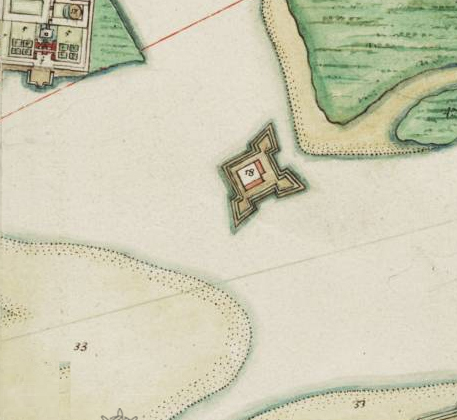
Fort Waerdenburgh stood on a point of land at the confluence of the Beberibe river with the Capibaribe river, in the present-day city of Recife, on the coast of the state of Pernambuco, in Brazil.
Machine-translated from “Forte Waerdemburch” on the Portuguese Wikipedia, CC BY-SA 4.0.
Fort Waerdenburgh ranks #8,062 of 8,134 worldwide in the atlas's castle fame ranking, and #72 of the 80 mapped in Brazil. Founded 1630, it is older than 30% of the atlas's dated landmarks — one of 626 atlas entries founded in the 17th century. 5 more atlas landmarks stand within 25 km. See how Brazil compares in the castle statistics.
View on the interactive castle map →Frequently asked questions
Where is Fort Waerdenburgh?
Fort Waerdenburgh stands in Brazil, at -8.05596°, -34.8767°.
When was Fort Waerdenburgh built?
The atlas dates its founding to 1630. Earlier structures may have stood on the site; this is the earliest documented founding year.
How famous is Fort Waerdenburgh?
In this atlas's fame ranking: #8,062 of 8,134 worldwide, and #72 in Brazil. Fame here combines how many Wikipedia language editions cover a landmark with how many people read them.
What is the nearest castle to Fort Waerdenburgh?
Fortaleza da Madre de Deus e São Pedro, about 1 km away.
More castles in Brazil
- Tamandaré da Laje Fort Brazil
- Fort of Saint Peter Brazil · 16th century
- Fort of São Sebastião de Alcântara Brazil · 18th century
- Forte do Pontal da Cruz Brazil
More ruins
- Mirante do Atalaia de Forte Velho Brazil
- Hongyuan Fort China · 19th century
- Yangzuomie City Ruins China
- Acropolis of Athens Greece · 5th century BC