Fortress
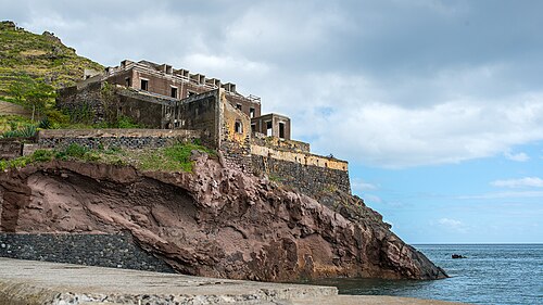
Fortaleza de Nossa Senhora da Conceição do Ilhéu
 Portugal · 17th century
- Founded
- c. 1700
- Heritage status
- Immovable Cultural Heritage of Public Interest
- Location
- Sé
- Coordinates
- 32.64111°, -16.91528°
- Open data
- Wikidata Q3510255
- Links
- OpenStreetMap · Wikimedia Commons
Description
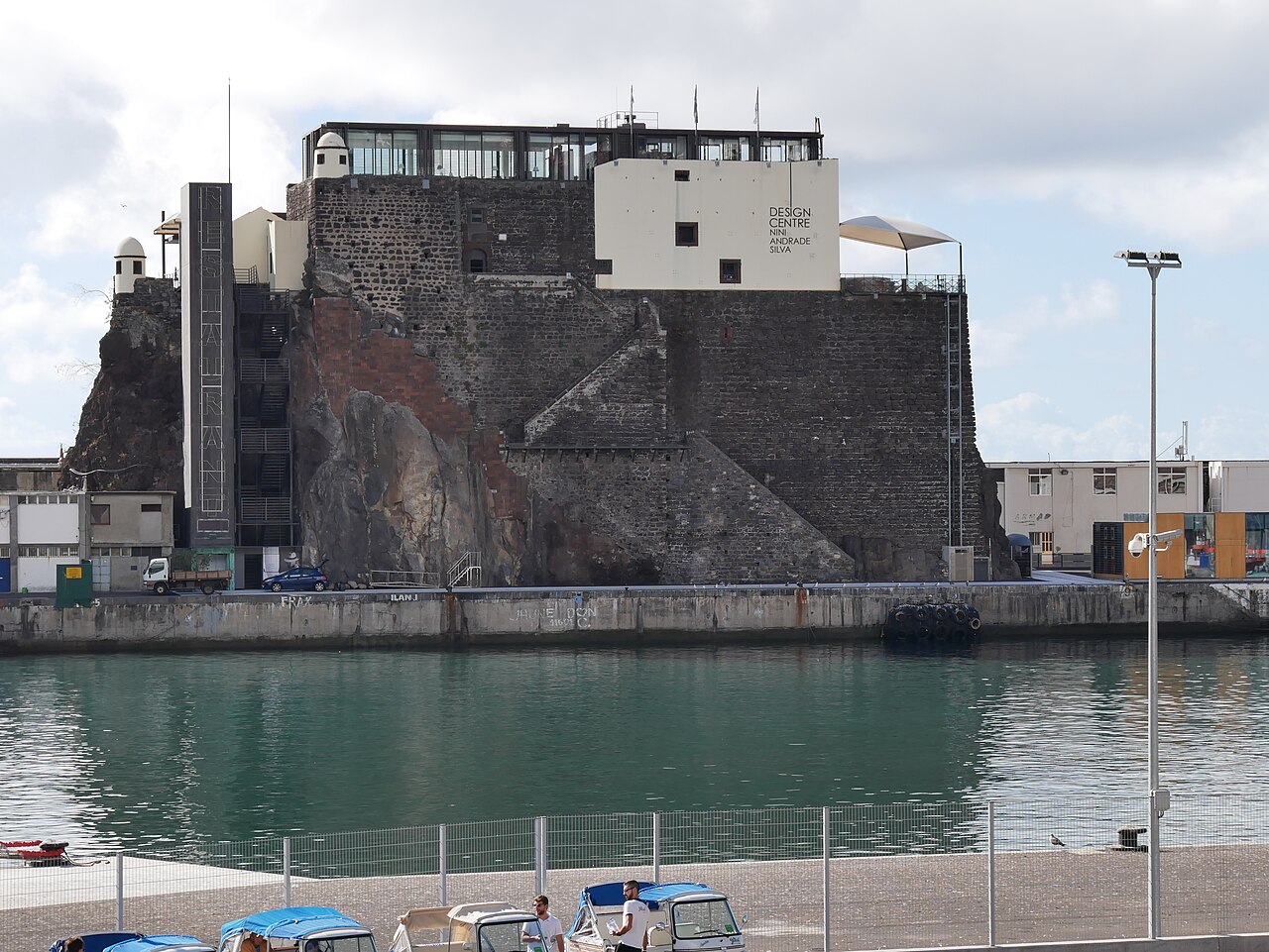
The fortress Fortaleza de Nossa Senhora da Conceição do Ilhéu existed on an islet in the bay by the harbour of Funchal on Madeira.
The first proposal to build a fortress on the islet appeared as early as 1553. The main reason was the defence of the harbour against pirates. The work dragged on for almost a hundred years. It was accelerated by the war for Portugal's independence from Spain (1640–1668).
After the First World War the harbour was enlarged. Today the former islet is part of the pier and the harbour's control station is located on it.
Machine-translated from “Forte do Ilhéu (Funchal)” on the Czech Wikipedia, CC BY-SA 4.0.
In the rankings
Fortaleza de Nossa Senhora da Conceição do Ilhéu ranks #9,298 of 9,902 worldwide in the atlas's castle fame ranking, and #209 of the 213 mapped in Portugal. Founded c. 1700, it is older than 22% of the atlas's dated landmarks, one of 755 atlas entries founded in the 17th century. 4 more atlas landmarks stand within 25 km. See how Portugal compares in the castle statistics.
Castles nearby
- Palácio de São Lourenço1 km · Portugal
- Fortaleza de São Tiago2 km · Portugal
- Forte de Nossa Senhora do Amparo16 km · Portugal
- Forte de São João Baptista17 km · Portugal
More castles in Portugal
- Castle of BragaPortugal
- Castle of FariaPortugal
- Torre de LapelaPortugal · 14th century
- Castelo de SinesPortugal