Fortress
Furg Citadel
🇮🇷 Iran · 18th century
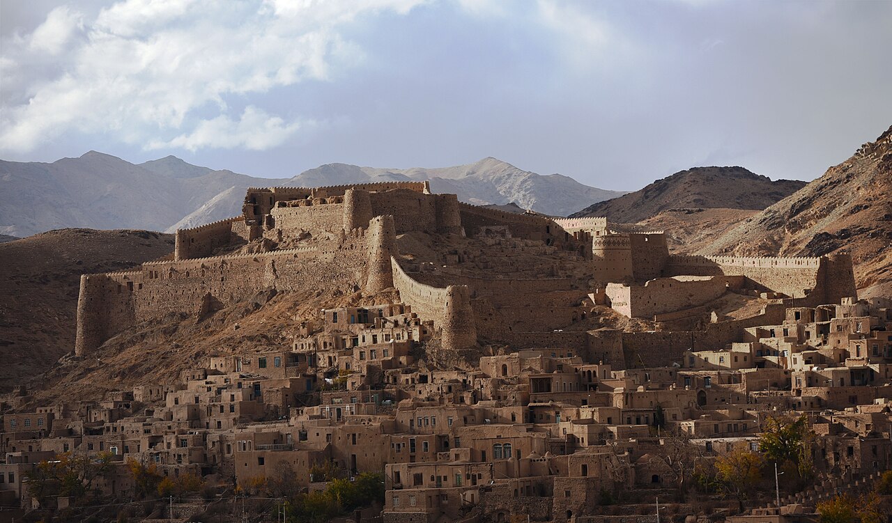
Furg Citadel (Persian: ارگ فورگ, romanized: Arg-e Furg), also known as Forg citadel and Mirza Rafi Khan citadel, is an 18th-century citadel located in Furg Village in Darmian County, South Khorasan province, Iran.
Furg Citadel was constructed by Meerza Muhammad Rafiee Darmiany I (Lama). It was registered in the List of National Works on 18 March 2001.
There are different origin stories for the name of Forg/Furg. One of the more common is that Forg was commonly pronounced "Fork" among the people. The Dehkhoda Dictionary, in a quote from the Encyclopedia, explicitly mentions that "Fork" was the name of the ancestor of a family in Iran, and is an Iranian name.
Other versions suggest that Fork was the name of the daughter of "Ryan Konouj", an Indian king; that Fork was the wife of Bahram Gour (as stated in Borhan); and/or that perhaps the name stems from the Persian word pour, meaning "son". Still other theories attribute Fork to the founder of this village, i.e. Mozafar Keyghobad, and based on an inscription on which the year of 307 is written, they infer that as the founder of this village was initially "Pour Keyghobad", it was first called "Pourg", and then renamed to Fork and then to Forg over time.
Furg Citadel is located on the north side of Fork Village at an altitude of 1840 meters. It is on the edge of the heights of Darmian Valley, leading to the Asadiyeh plain. Furg Citadel covers about 9,200 square meters, extending from east to west.
Section 1 of the citadel contains a barn on the east side that served as living quarters for the staff, as a cattle barn and as a dock warehouse.
This section also includes a citadel entrance, guard towers, water storage and other spaces.
Section 2 is a tall central area that is 50 meters from the storage areas, armory and barracks. The citadel has a brick tower with cruciform or lozenge design decorations in the northeast corner.
Section 3 encompasses two floors overlooking the village and roads of the area. It is located in the west and is separated from section 2 by two towers and fortified and long walls. Most of the second floor has been destroyed.
The tunnel has approximately 100 usable stairs.
The current tunnel was allegedly used during the battle between Mirza Rafi Khan with Mir Alam Khan and his son Amir Asadollah Khan.
Text adapted from “Furg Citadel” on Wikipedia, CC BY-SA 4.0.
Furg Citadel ranks #4,305 of 8,764 worldwide in the atlas's castle fame ranking, and #46 of the 173 mapped in Iran. Founded c. 1750, it is older than 18% of the atlas's dated landmarks — one of 638 atlas entries founded in the 18th century. See how Iran compares in the castle statistics.
View on the interactive castle map →Frequently asked questions
Where is Furg Citadel?
Furg Citadel stands in Iran, at 32.845°, 59.94833°.
When was Furg Citadel built?
The atlas dates its founding to c. 1750. Earlier structures may have stood on the site; this is the earliest documented founding year.
How famous is Furg Citadel?
In this atlas's fame ranking: #4,305 of 8,764 worldwide, and #46 in Iran. Fame here combines how many Wikipedia language editions cover a landmark with how many people read them.
What is the nearest castle to Furg Citadel?
Kuh-e Zardan Castle, about 76 km away.
More castles in Iran
- Sun Palace Iran · 18th century
- Southern Saru Castle Iran
- Behestan Castle Iran
- Kangelo Castle Iran
More fortresses
- Ligny Tower Italy · 17th century
- Qawra Tower Malta · 17th century
- Rinella Battery Malta · 19th century
- Dhayah Fort United Arab Emirates · 18th century