 Northern Ireland · 17th century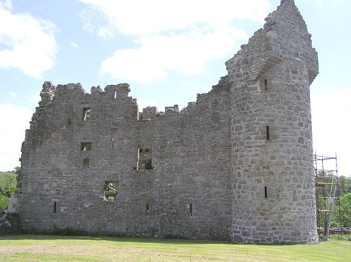
Monea Castle is a castle located in Monea, County Fermanagh, Northern Ireland. It is a State Care Historic Monument situated in the townland of Castletown Monea, in Fermanagh District Council area, at grid ref: H1647 4937.
Monea Castle is situated where a Maguire castle once existed prior to the Plantation, with a crannog still visible. Construction of the building began in 1616 (1616), and a bawn was added later in 1622. During the Irish Rebellion of 1641, the castle was attacked by Rory Maguire while it was being used to shelter Protestants.
Text adapted from “Monea castle” on Wikipedia, CC BY-SA 4.0.
Monea Castle ranks #6,742 of 9,079 worldwide in the atlas's castle fame ranking, and #26 of the 39 mapped in Northern Ireland. Founded 1616, it is older than 30% of the atlas's dated landmarks — one of 721 atlas entries founded in the 17th century. 7 more atlas landmarks stand within 25 km. The nearest day-trip guide is Derry, 72 km away. See how Northern Ireland compares in the castle statistics.
View on the interactive castle map →