 Afghanistan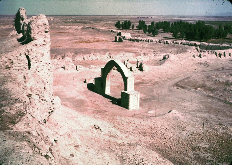
The Fort of Bost, locally referred to as Qala-e-Bost (Dari: قلعه بست; Pashto: بست کلا), is a fortification near Lashkargah in the Helmand Province of Afghanistan, which is believed by some to have been built approximately 3,000 years ago. It has been visited by many locals and foreign tourists throughout history. The archaeological site covers an area of around 10 kilometers (or 8 miles).
The Fort of Bost is located at 31° 30’ 02″ N, 64° 21’ 24″ E near the convergence of the Helmand and Arghandab rivers, about 6 miles south of Lashkargah. The site is famous for its 11th century decorative arch, which appears on the 100 afghani note (Afghan currency). The arch is part of the remains of an ancient mosque. Those who visited the fortress described it as a thriving community, with many fresh fruit and date palm trees in the area.
Text adapted from “Fort of Bost” on Wikipedia, CC BY-SA 4.0.
Qala-e-Bost ranks #4,513 of 9,035 worldwide in the atlas's castle fame ranking, and #9 of the 12 mapped in Afghanistan. See how Afghanistan compares in the castle statistics.
View on the interactive castle map →