 Niederlande · 16. Jahrhundert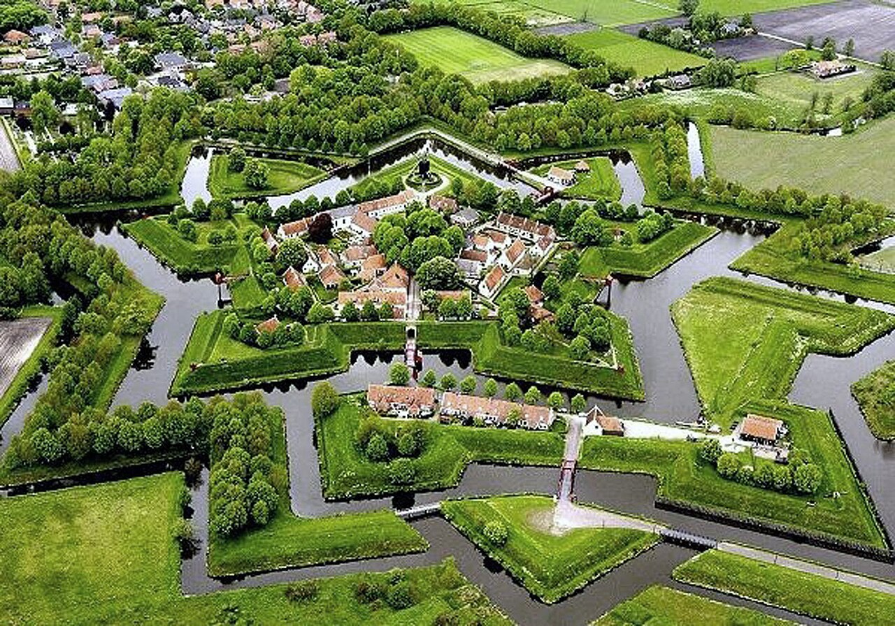
Die Festung Bourtange (niederländisch: Vesting Bourtange) ist eine Festung im Dorf Bourtange, Groningen, Niederlande. Sie wurde auf Befehl Wilhelms des Schweigsamen erbaut und 1593 fertiggestellt. Ihr ursprünglicher Zweck war es, die einzige Straße zwischen Deutschland und der Stadt Groningen zu kontrollieren, die zur Zeit des Achtzigjährigen Krieges von den Spaniern beherrscht wurde.
Nach ihrer letzten Schlacht im Jahr 1672 diente die Festung weiterhin im Verteidigungsnetz an der deutschen Grenze, bis sie 1851 endgültig aufgegeben und in ein Dorf umgewandelt wurde. Die Festung Bourtange dient heute als historisches Museum.
Maschinell übersetzt aus „Fort Bourtange“ in der englischsprachigen Wikipedia, CC BY-SA 4.0.
Festung Bourtange steht weltweit auf Platz 1.209 von 9.079 im Burgen-Bekanntheitsranking des Atlas und Nr. 11 der 199 in den Niederlanden verzeichneten. Die Gründung fällt auf 1593: früher als bei 33% der datierten Objekte des Atlas, eines von 891 Atlas-Objekten, die im 16. Jahrhundert gegründet wurden. Die Wikipedia-Artikel dazu wurden in den letzten 60 Tagen 10.707-mal geöffnet, mehr als 94% des Atlas. Im Umkreis von 25 km stehen 2 weitere Objekte des Atlas. Der nächste Ausflugs-Guide ist Enschede, 89 km entfernt. Sehen Sie in der Burgen-Statistik, wie die Niederlande abschneiden.
Auf der interaktiven Burgenkarte ansehen →