 Netherlands · 16th century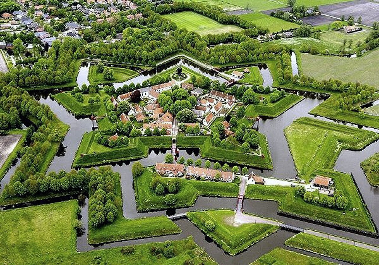
Fort Bourtange (Dutch: Vesting Bourtange) is a fort in the village of Bourtange, Groningen, Netherlands. It was built under orders of William the Silent and completed in 1593. Its original purpose was to control the only road between Germany and the city of Groningen, which was controlled by the Spaniards during the time of the Eighty Years' War.
After experiencing its final battle in 1672, the fort continued to serve in the defensive network on the German border until it was finally given up in 1851 and converted into a village. Fort Bourtange currently serves as a historical museum.
Text adapted from “Fort Bourtange” on Wikipedia, CC BY-SA 4.0.
Fort Bourtange ranks #1,209 of 9,079 worldwide in the atlas's castle fame ranking, and #11 of the 199 mapped in Netherlands. Founded 1593, it is older than 33% of the atlas's dated landmarks — one of 891 atlas entries founded in the 16th century. Its Wikipedia articles were opened 10,707 times in the last 60 days, more than 94% of the atlas. 2 more atlas landmarks stand within 25 km. The nearest day-trip guide is Enschede, 89 km away. See how Netherlands compares in the castle statistics.
View on the interactive castle map →