 Israel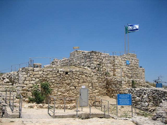
Der Nationalpark Castel (hebräisch: גן לאומי קסטל) ist ein israelischer Nationalpark, der aus einem befestigten Gipfel im Judäischen Bergland besteht, an der Stelle des ehemaligen palästinensischen Dorfes Al-Qastal, das den hebräischsprachigen Bewohnern als HaCastel, „der Castel“, bekannt ist. Er liegt 8 km westlich von Jerusalem an der Straße, die die Stadt mit Tel Aviv verbindet (Highway 1).
Die Stätte ist vor allem als Schauplatz der entscheidenden Schlachten der Operation Nachschon bekannt, die dort im April 1948 während des Arabisch-Israelischen Krieges von 1948 ausgetragen wurden. Dort fanden erbitterte, verlustreiche Kämpfe statt, als Araber und Juden um die Kontrolle der Stätte kämpften, die die Hauptstraße zwischen Tel Aviv und Jerusalem überblickte. Castel wechselte im Verlauf der Kämpfe mehrfach den Besitzer. Die Wende kam, als der angesehene arabische Kommandant Abd al-Qadir al-Husseini getötet wurde. Viele der Araber verließen ihre Stellungen, um am 9. April, einem Freitag, an al-Husseinis Begräbnis in der Al-Aqsa-Moschee teilzunehmen. Am selben Tag fiel Castel praktisch kampflos an die israelischen Streitkräfte.
Der Nationalpark umfasst ein Gedenkmal für die dort gefallenen israelischen Soldaten, darunter ein 1980 von Yitzhak Yamin entworfenes Denkmal, sowie ein Denkmal für die Konvois, die versuchten, die Blockade Jerusalems zu durchbrechen.
Maschinell übersetzt aus „Castel National Park“ in der englischsprachigen Wikipedia, CC BY-SA 4.0.
Castel National Park steht weltweit auf Platz 4.159 von 9.079 im Burgen-Bekanntheitsranking des Atlas und Nr. 15 der 23 in Israel verzeichneten. Im Umkreis von 25 km stehen 5 weitere Objekte des Atlas. Der nächste Ausflugs-Guide ist Jerusalem, 9 km entfernt. Die Anlage gehört zu den 106 Objekten auf der Regionalkarte Levante. Sehen Sie in der Burgen-Statistik, wie Israel abschneidet.
Auf der interaktiven Burgenkarte ansehen →