 Israel · 13. Jahrhundert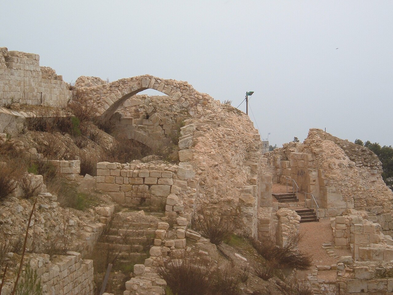
Die Zitadelle von Safed ist eine heute nicht mehr existierende Festungsburg auf dem Gipfel des Berges, auf dem die heutige Stadt Safed liegt. Befestigungsanlagen bestanden bereits in der Spätzeit des Zweiten Tempels sowie in der Römerzeit. Die meisten der noch erhaltenen Überreste stammen jedoch aus der Kreuzfahrer-, Mamluken- und Osmanenzeit. Die Zitadelle war ein bedeutendes Verwaltungszentrum der Kreuzfahrer. Sie wurde bei dem starken Erdbeben, das Safed 1837 heimsuchte, schwer beschädigt. In den letzten Jahrzehnten wurden am Standort umfangreiche archäologische Ausgrabungen durchgeführt, bei denen Überreste und antike Funde aus allen Perioden der Geschichte der Zitadelle zutage kamen.
Heute wird die Zitadelle sowohl wegen ihres historischen Werts als auch wegen der Aussicht von Touristen besucht, da man von ihrer erhöhten Lage aus die Umgebung von Safed überblicken kann: das Bergmassiv von Meron im Westen, den See Genezareth im Osten, das untere Galiläa im Süden sowie die Berge Naftali und Hermon im Norden. Der Garten der Zitadelle wurde 1950 nach Entwürfen des Landschaftsarchitekten Shlomo Oren Weinberg angelegt. Für die Einwohner Safeds, die im Palästinakrieg 1948 ihr Leben verloren, wurde ein Gedenkdenkmal errichtet.
Maschinell übersetzt aus „Citadel of Safed“ in der englischsprachigen Wikipedia, CC BY-SA 4.0.
Safed Fortress steht weltweit auf Platz 3.452 von 9.035 im Burgen-Bekanntheitsranking des Atlas und Nr. 14 der 23 in Israel verzeichneten. Die Gründung fällt auf 1240: früher als bei 71% der datierten Objekte des Atlas, eines von 1090 Atlas-Objekten, die im 13. Jahrhundert gegründet wurden. Die Wikipedia-Artikel dazu wurden in den letzten 60 Tagen 1.267-mal geöffnet, mehr als 57% des Atlas. Im Umkreis von 25 km stehen 3 weitere Objekte des Atlas. Der nächste Ausflugs-Guide ist Tyros, 43 km entfernt. Die Anlage gehört zu den 105 Objekten auf der Regionalkarte Levante. Sehen Sie in der Burgen-Statistik, wie Israel abschneidet.
Auf der interaktiven Burgenkarte ansehen →