Fortaleza
Fort Denison
🇦🇺 Australia · siglo XVIII
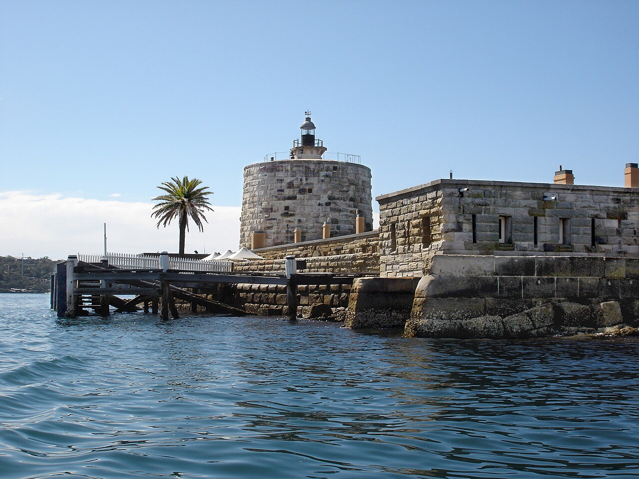
El fuerte Denison, parte del parque nacional del Puerto de Sídney, es un antiguo recinto penal e instalación defensiva incluido en el registro del patrimonio, que ocupa una pequeña isla situada al noreste del Real Jardín Botánico y a aproximadamente 1 kilómetro (0,62 mi) al este de la Ópera, en el puerto de Sídney, Nueva Gales del Sur, Australia. La isla pudo haber sido conocida como Mattewanye o Muddawahnyuh en la lengua eora, y como Pinchgut Island.
El lugar alberga un cañón horario, ayudas a la navegación e instalaciones de mareógrafo. Las instalaciones penitenciarias y militares fueron diseñadas por George Barney y construidas entre 1840 y 1862 por William Randle. La propiedad pertenece a la Office of Environment & Heritage. Fue incluida en el Registro del Patrimonio Estatal de Nueva Gales del Sur el 2 de abril de 1999. En 1978 la antigua fortaleza fue inscrita en el (hoy desaparecido) Register of the National Estate, y actualmente se utiliza como parque nacional, reserva natural, instalación turística y espacio para eventos.
Traducción automática de «Fort Denison» en la Wikipedia en inglés, CC BY-SA 4.0.
Fort Denison ocupa el puesto 2319 de 8134 en el mundo en la clasificación de fama de este atlas y el n.º 1 de los 14 que el atlas cartografía en Australia. Su fundación, en 1788, es anterior a la del 14% de los monumentos datados del atlas — uno de los 556 monumentos del atlas fundados en el siglo XVIII. Sus artículos de Wikipedia se abrieron 2961 veces en los últimos 60 días, más que el 75% del atlas. En 25 km a la redonda hay otros 5 monumentos del atlas. Compara el dato en las estadísticas de castillos.
Ver en el mapa interactivo de castillos →Preguntas frecuentes
¿Dónde está Fort Denison?
La fortaleza se encuentra en Australia, en las coordenadas -33.85478°, 151.22563°.
¿De qué año data Fort Denison?
El atlas fija su fundación en 1788. Pudieron existir construcciones anteriores en el mismo lugar; este es el año documentado más antiguo.
¿Qué puesto ocupa Fort Denison en la clasificación por fama?
En la clasificación por fama de este atlas: n.º 2319 de 8134 en el mundo, y n.º 1 en Australia. La fama combina en cuántas ediciones de Wikipedia aparece un monumento y cuánta gente las lee.
¿Qué castillo está más cerca de Fort Denison?
Fort Macquarie, a unos 1 km.
Más castillos en Australia
- South Channel Fort Australia · siglo XIX
- Fort Nepean Australia · siglo XIX
- Fort Glanville Australia · siglo XIX
- Fort Queenscliff Australia · siglo XIX
Más fortalezas
- Fuerte Viejo de Zanzíbar Tanzania · siglo XVII
- Fortaleza Vieja de Livorno Italia · siglo XI
- Fuerte Zeelandia (Guyana) Guyana · siglo XVIII
- Fuerte del Pilar Filipinas · siglo XVII