Fortaleza
Fort Louvois
🇫🇷 Francia · siglo XVII
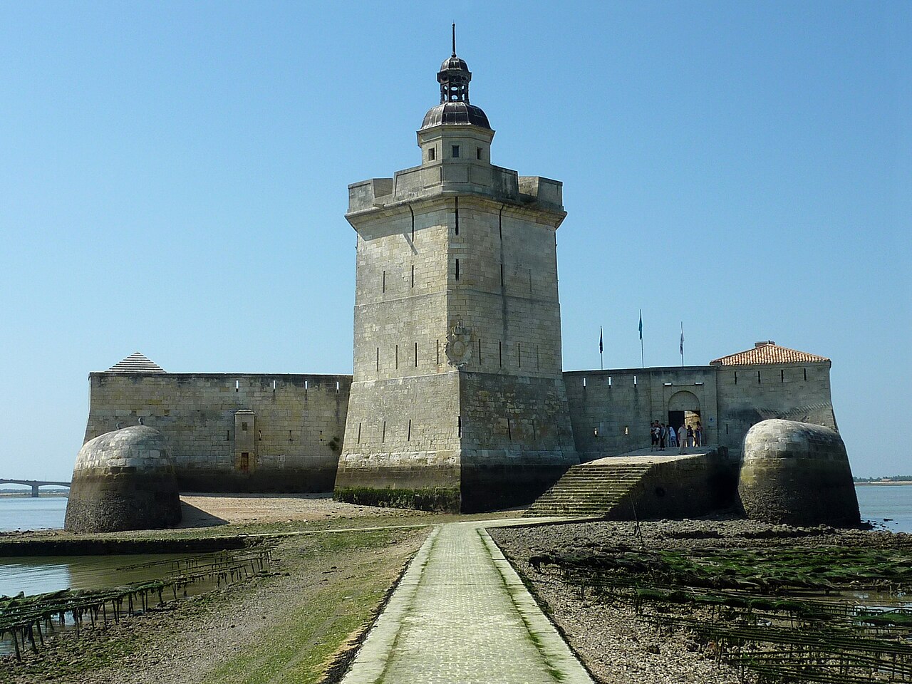
El Fort Louvois, conocido localmente como Fort Chapus o Fort du Chapus, es una fortificación construida entre 1691 y 1694, durante el reinado de Luis XIV, en el islote de Chapus, a unos 400 metros (1300 pies) de la costa, en la localidad de Bourcefranc-le-Chapus, en el departamento de Charente-Marítimo, Francia. El fuerte se encuentra frente a la ciudadela del castillo de Oléron, en la isla de Oléron. El fuerte se posicionó de manera que el fuego cruzado del castillo y del fuerte controlara el Pertuis de Maumusson (paso de Maumusson) e impidiera el acceso desde el sur a las radas de Rochefort. El Fort Louvois solo vio acción hacia el final de la Segunda Guerra Mundial, cuando los bombardeos dañaron gravemente el fuerte, lo que obligó a una restauración posterior.
Desde 1972, el fuerte alberga un museo de ostricultura, y hay bancos de ostras junto a la calzada que une el fuerte con la costa. El fuerte también alberga una exposición permanente que describe su historia y contiene maquetas de fortificaciones de la costa de Charente. Durante el verano, un barco lanzadera que opera en marea alta lleva a los visitantes al fuerte; en marea baja, el fuerte es accesible por una calzada.
Traducción automática de «Fort Louvois» en la Wikipedia en inglés, CC BY-SA 4.0.
Fort Louvois ocupa el puesto 3648 de 8134 en el mundo en la clasificación de fama de este atlas y el n.º 276 de los 525 que el atlas cartografía en Francia. Su fundación, en 1691, es anterior a la del 23% de los monumentos datados del atlas — uno de los 626 monumentos del atlas fundados en el siglo XVII. Sus artículos de Wikipedia se abrieron 1555 veces en los últimos 60 días, más que el 60% del atlas. En 25 km a la redonda hay otros 1 monumentos del atlas. Compara el dato en las estadísticas de castillos.
Ver en el mapa interactivo de castillos →Preguntas frecuentes
¿Dónde está Fort Louvois?
La fortaleza se encuentra en Francia, en las coordenadas 45.8571°, -1.17425°.
¿De qué año data Fort Louvois?
El atlas fija su fundación en 1691. Pudieron existir construcciones anteriores en el mismo lugar; este es el año documentado más antiguo.
¿Qué puesto ocupa Fort Louvois en la clasificación por fama?
En la clasificación por fama de este atlas: n.º 3648 de 8134 en el mundo, y n.º 276 en Francia. La fama combina en cuántas ediciones de Wikipedia aparece un monumento y cuánta gente las lee.
¿Qué castillo está más cerca de Fort Louvois?
Fuerte Boyard, a unos 16 km.
Más castillos en Francia
- Fort de la Redoute Ruinée Francia · siglo XIX
- Petit Bé Francia · siglo XVII
- Fort Souville Francia · siglo XIX
- Château de Vizille Francia · siglo XII
Más fortalezas
- Forte Buso Italia · siglo XIX
- Fortaleza de Beliche Portugal · siglo XVII
- Fuerte de Ínsua Portugal
- Forte Tre Sassi Italia · siglo XIX