Forteresse
Tvrđa
🇭🇷 Croatie · XVIIIe siècle
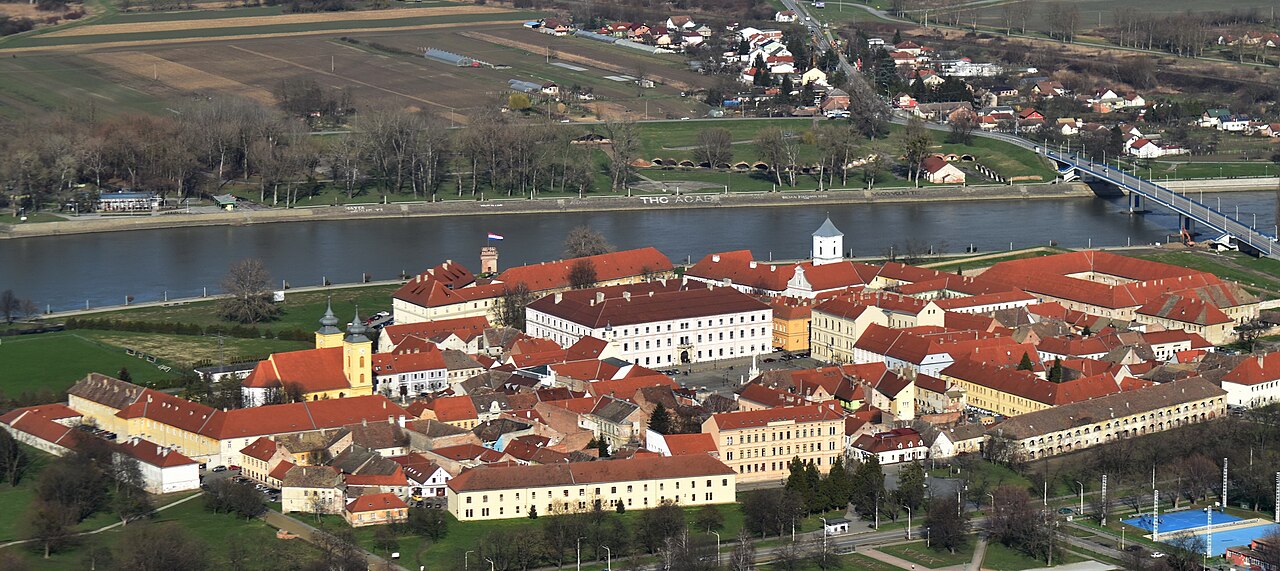
Tvrđa (la Citadelle) est la vieille ville de la cité d'Osijek, en Croatie. C'est l'ensemble baroque le mieux conservé et le plus vaste de Croatie, constitué d'une forteresse en étoile habsbourgeoise construite sur la rive droite de la rivière Drave. Tvrđa a été décrite par le World Monuments Fund comme « un exemple unique de centre urbain militaire, administratif et commercial baroque du XVIIIe siècle ».
La forteresse en étoile fut construite à proximité immédiate de l'Osijek médiévale après la défaite des forces ottomanes en 1687, en raison de l'importance stratégique d'Osijek. Sa construction débuta en 1712 selon les plans de Mathias von Kaiserfeld, puis de Maximilian Gosseau de Henef ; les cinq bastions prévus et les deux portes furent achevés en 1715. En 1735, la ville intérieure était terminée et trois bastions nord avaient été ajoutés. Une fois achevée, c'était la plus grande et la plus avancée des forteresses habsbourgeoises sur la frontière avec l'Empire ottoman, comptant huit bastions et comprenant des arsenaux, des dépôts, un quartier général de garnison, un tribunal militaire, un bureau de construction, un médecin de garnison, un corps de garde, des appartements d'officiers, un hôpital militaire et sept casernes.
La forteresse achevée était entièrement entourée de murs et de palissades, avec quatre portes principales de chaque côté (nord, sud, est, ouest). Tvrđa disposait d'un éclairage public dès 1717 et abrita le premier réseau d'eau public de Croatie, ouvert en 1751.
L'importance militaire de Tvrđa diminua après le congrès de Berlin de 1878, avec la stabilité croissante de la région environnante. La majeure partie des murs et fortifications du fort fut détruite dans les années 1920, en raison de l'obstacle qu'elle représentait pour le développement d'Osijek.
Traduction automatique de « Tvrđa » de la Wikipédia en anglais, CC BY-SA 4.0.
Tvrđa occupe la 1 642e place sur 8 134 au classement de renommée de cet atlas et le 15e rang des 61 que l’atlas recense en Croatie. Sa fondation, en 1712, est antérieure à celle de 21 % des monuments datés de l’atlas — l’un des 556 monuments de l’atlas fondés au XVIIIe siècle. Ses articles Wikipédia ont été ouverts 2 182 fois en 60 jours, plus que 69 % de l’atlas. Le guide d’excursion le plus proche est Novi Sad, à 95 km. Voyez comment la Croatie se compare dans les statistiques des châteaux.
Voir sur la carte interactive des châteaux →Questions fréquentes
Où se trouve Tvrđa ?
Tvrđa se trouve en Croatie, aux coordonnées 45.56107°, 18.69609°.
De quand date Tvrđa ?
L’atlas retient comme fondation 1712. Des constructions antérieures ont pu occuper le site ; c’est l’année de fondation documentée la plus ancienne.
Quelle est la renommée de Tvrđa ?
Au classement de renommée de cet atlas : 1 642e place sur 8 134 dans le monde, 15e place en Croatie. La renommée combine le nombre d’éditions de Wikipédia qui couvrent un monument et leur lectorat.
Quel château est le plus proche de Tvrđa ?
Le manoir Eltz, à environ 32 km.
D’autres châteaux en Croatie
- Brod Fortress Croatie · XVIIIe siècle
- Muraille de Ston Croatie · XIVe siècle
- Nehaj Fortress Croatie · XVIe siècle
- Tour Lotrščak Croatie · XIIIe siècle
D’autres forteresses
- Fort portugais de Ouidah Bénin · XVIIe siècle
- Kremlin de Toula Russie · XVIe siècle
- Fort Zeelandia (Suriname) Suriname · XVIIe siècle
- Forteresse de Ram Serbie · XVe siècle