Ruïne
Burgruine Straßfried
🇦🇹 Oostenrijk · 13e eeuw
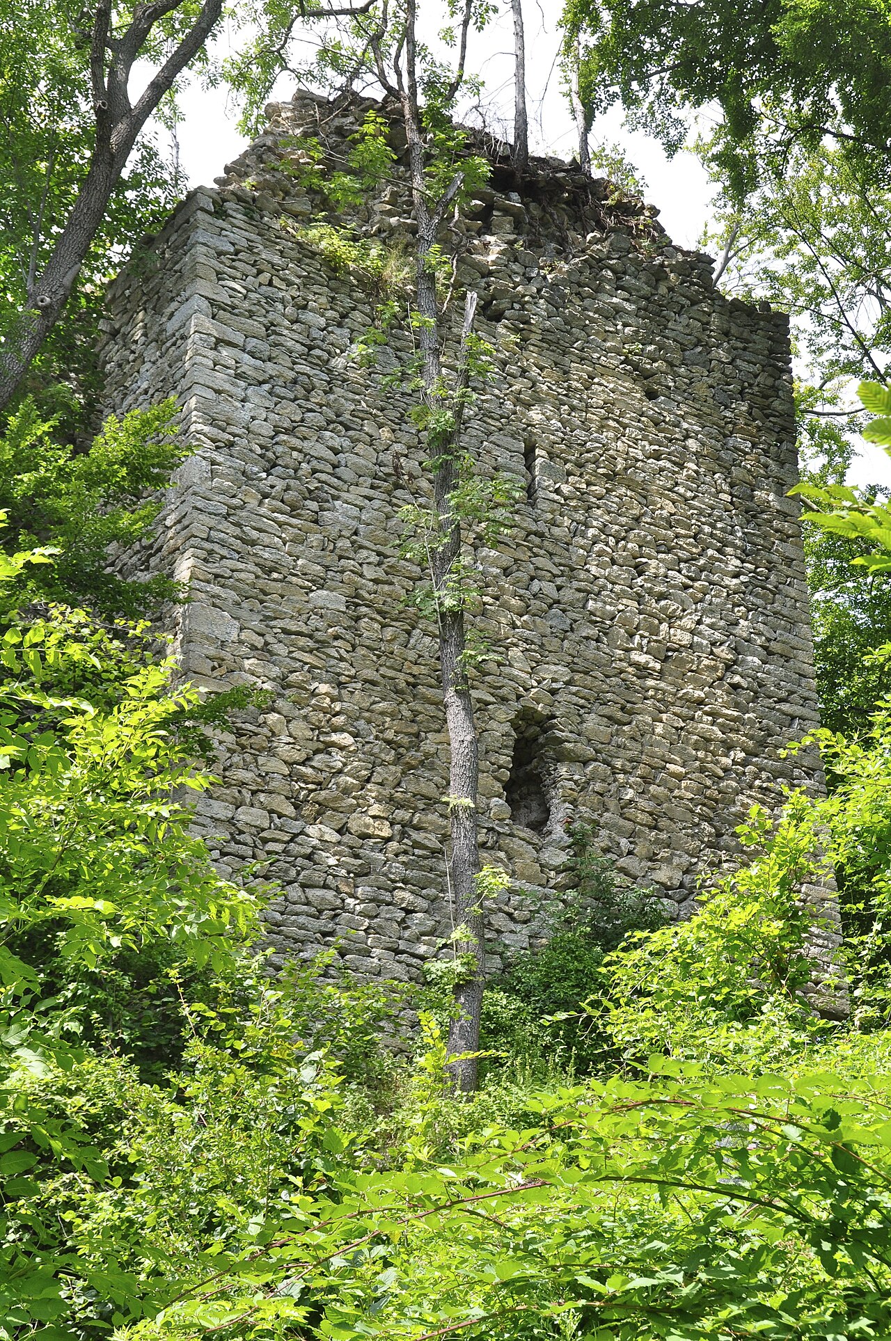
Burgruine Straßfried is een kasteel in Karinthië, Oostenrijk. Het ligt vlak bij de Oostenrijks-Italiaanse grens bij Arnoldstein in Karinthië.
De naam van het kasteel betekent "ruïne van kasteel Straßfried" en verwijst naar de ligging en het vroegere strategische belang ervan. Straßfried ligt op een beboste heuvel op het kruispunt van wegen vanuit Italië met een andere weg vanuit het dal van de Gail. Het kasteel wordt voor het eerst gedocumenteerd als Castrum Strazvrid in 1279, toen het bezit werd veroverd door de Habsburgse koning Rudolf. Het werd overgelaten aan het bisdom Bamberg. In de 13e eeuw werd het kasteel uitgebreid om de belangrijke handelsroutes waaraan het lag te bewaken.
Van de oorspronkelijke tweetorenaanleg is alleen de oostelijke van de twee bewaard gebleven. Aanzienlijke delen van de muur staan nog overeind, maar slechts kleine delen van het paleis zijn intact. Het werd zwaar beschadigd tijdens de Napoleontische oorlogen door Franse troepen, die in 1797 tijdens hun bezetting van Straatsburg een deel van de vesting opbliezen.
Machinaal vertaald uit “Burgruine Straßfried” op de Engelstalige Wikipedia, CC BY-SA 4.0.
Burgruine Straßfried staat op plaats 6.955 van 8.134 in de bekendheidsranglijst van deze atlas en op plaats 194 van de 201 die de atlas in Oostenrijk in kaart brengt. Gebouwd in 1279, en daarmee ouder dan 67% van de gedateerde bouwwerken in de atlas — een van de 861 bouwwerken in de atlas die uit de 13e eeuw stammen. Binnen 25 km staan nog 6 andere bouwwerken uit de atlas. De dichtstbijzijnde dagtripgids is Villach, 15 km verderop. Zie hoe dat zich verhoudt in de kastelenstatistiek.
Bekijk op de interactieve kastelenkaart →Veelgestelde vragen
Waar ligt Burgruine Straßfried?
Burgruine Straßfried ligt in Oostenrijk, op 46.5497°, 13.6608°.
Wanneer werd Burgruine Straßfried gebouwd?
De atlas dateert de stichting op 1279. Er kunnen eerdere bouwwerken hebben gestaan; dit is het oudste gedocumenteerde bouwjaar.
Hoe bekend is Burgruine Straßfried?
In de bekendheidsranglijst van deze atlas: plaats 6.955 van 8.134 wereldwijd, plaats 194 in Oostenrijk. Bekendheid combineert het aantal Wikipedia-taalversies met het aantal lezers.
Welk kasteel ligt het dichtst bij Burgruine Straßfried?
Burgruine Federaun, ongeveer 12 km verderop.
Meer kastelen in Oostenrijk
- Burgruine Arnulfsfeste Oostenrijk
- Burgruine Dobra Oostenrijk
- Schloss Petersberg Oostenrijk
- Rabenstein Castle Oostenrijk · 11e eeuw
Meer ruïnes
- Unspunnen Castle Zwitserland · 13e eeuw
- Vítkův hrádek Tsjechië · 13e eeuw
- Burgruine Kollmitz Oostenrijk · 14e eeuw
- Střmen Tsjechië · 13e eeuw