Vesting
Fort Armstrong
🇺🇸 Verenigde Staten · 19e eeuw
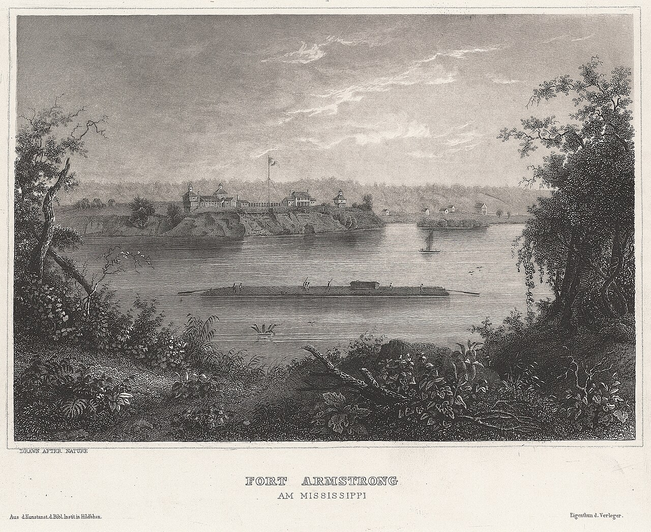
Fort Armstrong (1816-1836) was een van een reeks westelijke grensverdedigingswerken die de Verenigde Staten oprichtten na de Oorlog van 1812. Het lag aan de voet van Rock Island, in de rivier de Mississippi, nabij de huidige Quad Cities van Illinois en Iowa. Het lag vijf mijl van het belangrijkste Sauk- en Meskwaki-dorp aan de Rock River in Illinois. Het fort, gebouwd uit steen en hout, 300 voet vierkant, werd in mei 1816 begonnen en het jaar daarop voltooid, en bestond uit drie grote blokhuizen, zoals de replica, op zijn prominente hoeken. In 1832 gebruikte het Amerikaanse leger het fort als militair hoofdkwartier tijdens de Black Hawk-oorlog.
Het werd normaliter bemand door twee compagnieën reguliere Amerikaanse legertroepen. Met de pacificatie van de Indiaanse dreiging in Illinois staakte de Amerikaanse regering de activiteiten in Fort Armstrong, en het Amerikaanse leger verliet het grensfort in 1836.
Machinaal vertaald uit “Fort Armstrong (Illinois)” op de Engelstalige Wikipedia, CC BY-SA 4.0.
Fort Armstrong staat op plaats 5.799 van 8.134 in de bekendheidsranglijst van deze atlas en op plaats 96 van de 103 die de atlas in de Verenigde Staten in kaart brengt. Gebouwd in 1816, en daarmee ouder dan 12% van de gedateerde bouwwerken in de atlas — een van de 607 bouwwerken in de atlas die uit de 19e eeuw stammen. Zie hoe dat zich verhoudt in de kastelenstatistiek.
Bekijk op de interactieve kastelenkaart →Veelgestelde vragen
Waar ligt Fort Armstrong?
Fort Armstrong ligt in de Verenigde Staten, op 41.5165°, -90.5639°.
Wanneer werd Fort Armstrong gebouwd?
De atlas dateert de stichting op 1816. Er kunnen eerdere bouwwerken hebben gestaan; dit is het oudste gedocumenteerde bouwjaar.
Hoe bekend is Fort Armstrong?
In de bekendheidsranglijst van deze atlas: plaats 5.799 van 8.134 wereldwijd, plaats 96 in de Verenigde Staten. Bekendheid combineert het aantal Wikipedia-taalversies met het aantal lezers.
Welk kasteel ligt het dichtst bij Fort Armstrong?
Fort Dearborn, ongeveer 248 km verderop.
Meer kastelen in de Verenigde Staten
- Castle Pinckney Verenigde Staten · 18e eeuw
- Fort Washakie Verenigde Staten · 19e eeuw
- Fort Boise Verenigde Staten · 19e eeuw
- Fort James Jackson Verenigde Staten · 19e eeuw
Meer vestingen
- Fjell Fortress Noorwegen
- Fort d'Andoy België · 19e eeuw
- Fort Lantin België · 19e eeuw
- Fort McClary Verenigde Staten · 19e eeuw