Vesting
Fort Frontenac
🇨🇦 Canada · 17e eeuw
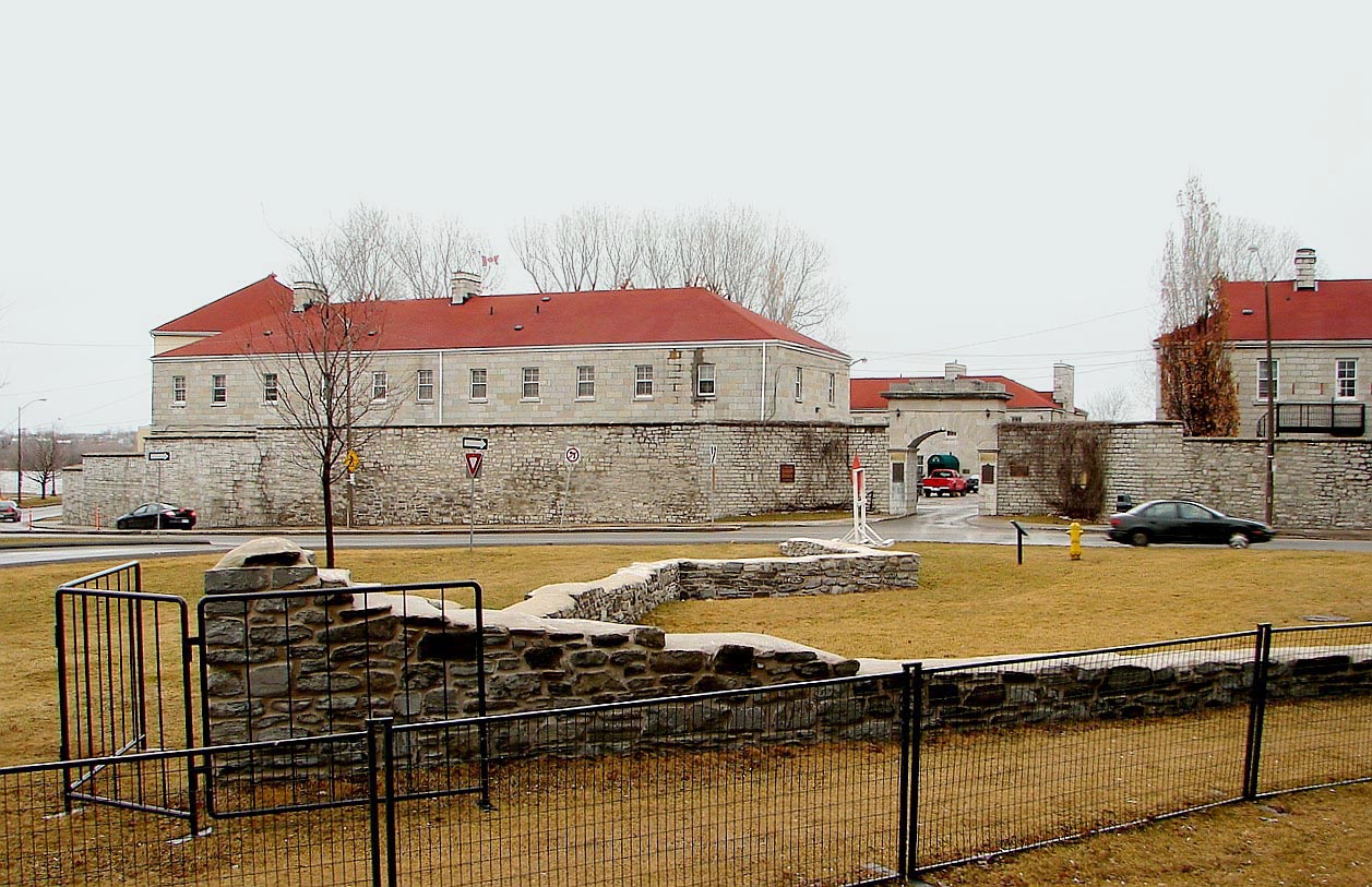
Fort Frontenac was een Franse handelspost en militair fort, gebouwd in juli 1673 aan de monding van de Cataraqui-rivier waar de Saint Lawrence-rivier het Ontariomeer verlaat (op wat nu het westelijke uiteinde van de La Salle Causeway is), op een plaats die van oudsher bekendstond als Cataraqui. Het is de huidige locatie van Kingston, Ontario, Canada. Het oorspronkelijke fort, een ruwe, houten palissadeconstructie, heette Fort Cataraqui, maar werd later vernoemd naar Louis de Buade de Frontenac, gouverneur van Nieuw-Frankrijk, die verantwoordelijk was voor de bouw van het fort. Het werd in 1689 verlaten en met de grond gelijkgemaakt, en vervolgens in 1695 herbouwd.
De Britten verwoestten het fort in 1758 tijdens de Zevenjarige Oorlog, waarna de ruïnes verlaten bleven totdat de Britten het in 1783 in bezit namen en herbouwden. In 1870–71 werd het fort overgedragen aan het Canadese leger, dat het nog altijd gebruikt.
Machinaal vertaald uit “Fort Frontenac” op de Engelstalige Wikipedia, CC BY-SA 4.0.
Fort Frontenac staat op plaats 1.622 van 8.134 in de bekendheidsranglijst van deze atlas en op plaats 5 van de 25 die de atlas in Canada in kaart brengt. Gebouwd in 1673, en daarmee ouder dan 25% van de gedateerde bouwwerken in de atlas — een van de 626 bouwwerken in de atlas die uit de 17e eeuw stammen. De Wikipedia-artikelen erover werden de afgelopen 60 dagen 3.028 keer geopend, meer dan 76% van de atlas. Binnen 25 km staan nog 1 andere bouwwerken uit de atlas. Zie hoe dat zich verhoudt in de kastelenstatistiek.
Bekijk op de interactieve kastelenkaart →Veelgestelde vragen
Waar ligt Fort Frontenac?
Fort Frontenac ligt in Canada, op 44.23333°, -76.47861°.
Wanneer werd Fort Frontenac gebouwd?
De atlas dateert de stichting op 1673. Er kunnen eerdere bouwwerken hebben gestaan; dit is het oudste gedocumenteerde bouwjaar.
Hoe bekend is Fort Frontenac?
In de bekendheidsranglijst van deze atlas: plaats 1.622 van 8.134 wereldwijd, plaats 5 in Canada. Bekendheid combineert het aantal Wikipedia-taalversies met het aantal lezers.
Welk kasteel ligt het dichtst bij Fort Frontenac?
Fort Henry, ongeveer 2 km verderop.
Meer kastelen in Canada
- Fort Beauséjour Canada · 18e eeuw
- Chateau St. Louis Canada · 17e eeuw
- Fort Carlton Canada · 19e eeuw
- Fort San Miguel Canada · 18e eeuw
Meer vestingen
- Fortaleza de Sagres Portugal · 15e eeuw
- Fort Amsterdam (Ghana) Ghana · 17e eeuw
- Baltit Fort Pakistan · 8e eeuw
- Khānderi Island India