Ruin
Alamparai Fort
 India · 17th century
- Founded
- c. 1675
- Heritage status
- State Protected Monument
- Location
- Chengalpattu district
- Coordinates
- 12.2659°, 80.0101°
- Open data
- Wikidata Q468734
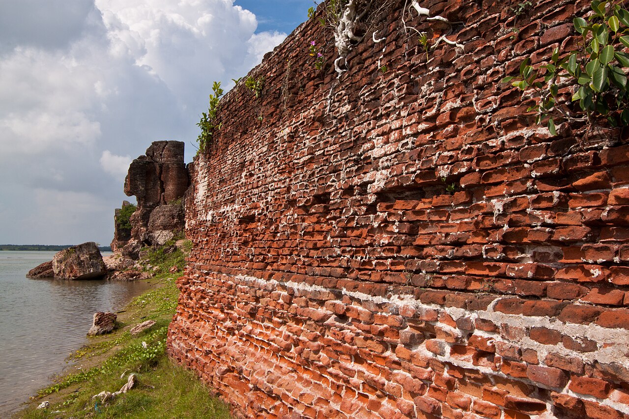
Description
The ruins of Alamparai Fort (also called Alampara) lie near Kadappakkam in India, a village 50 km from Mamallapuram on the land overlooking the sea. Constructed in the late 17th century during the Mughal era, the Alamparai Fort once had a 100-metre long dockyard stretching into the sea, from which zari cloth, salt, and ghee were exported. During 1735 AD it was ruled by Nawab Doste Ali Khan. In 1750, for the services rendered by the famous French commander Dupleix to Subedar Muzaffar Jung, the fort was given to the French. When French were defeated by the British, the fort was captured and demolished in 1760 AD. More recently the structure was damaged in the 2004 Indian Ocean earthquake.
Text adapted from “Alamparai Fort” on Wikipedia, CC BY-SA 4.0.
In the rankings
Alamparai Fort ranks #5,526 of 9,040 worldwide in the atlas's castle fame ranking, and #182 of the 223 mapped in India. Founded c. 1675, it is older than 23% of the atlas's dated landmarks, one of 710 atlas entries founded in the 17th century. Its Wikipedia articles were opened 1,022 times in the last 60 days, more than 51% of the atlas. See how India compares in the castle statistics.
Castles nearby
- Fort Sadras33 km · India
- Fort St. David64 km · India
- Gingee Fort67 km · India
- Fort St. George95 km · India
More castles in India
- Bankot FortIndia
- Bellary FortIndia
- Deeg PalaceIndia · 18th century
- Kandhar FortIndia