Ruin
Burgruine Gradenegg
🇦🇹 Austria · 12th century
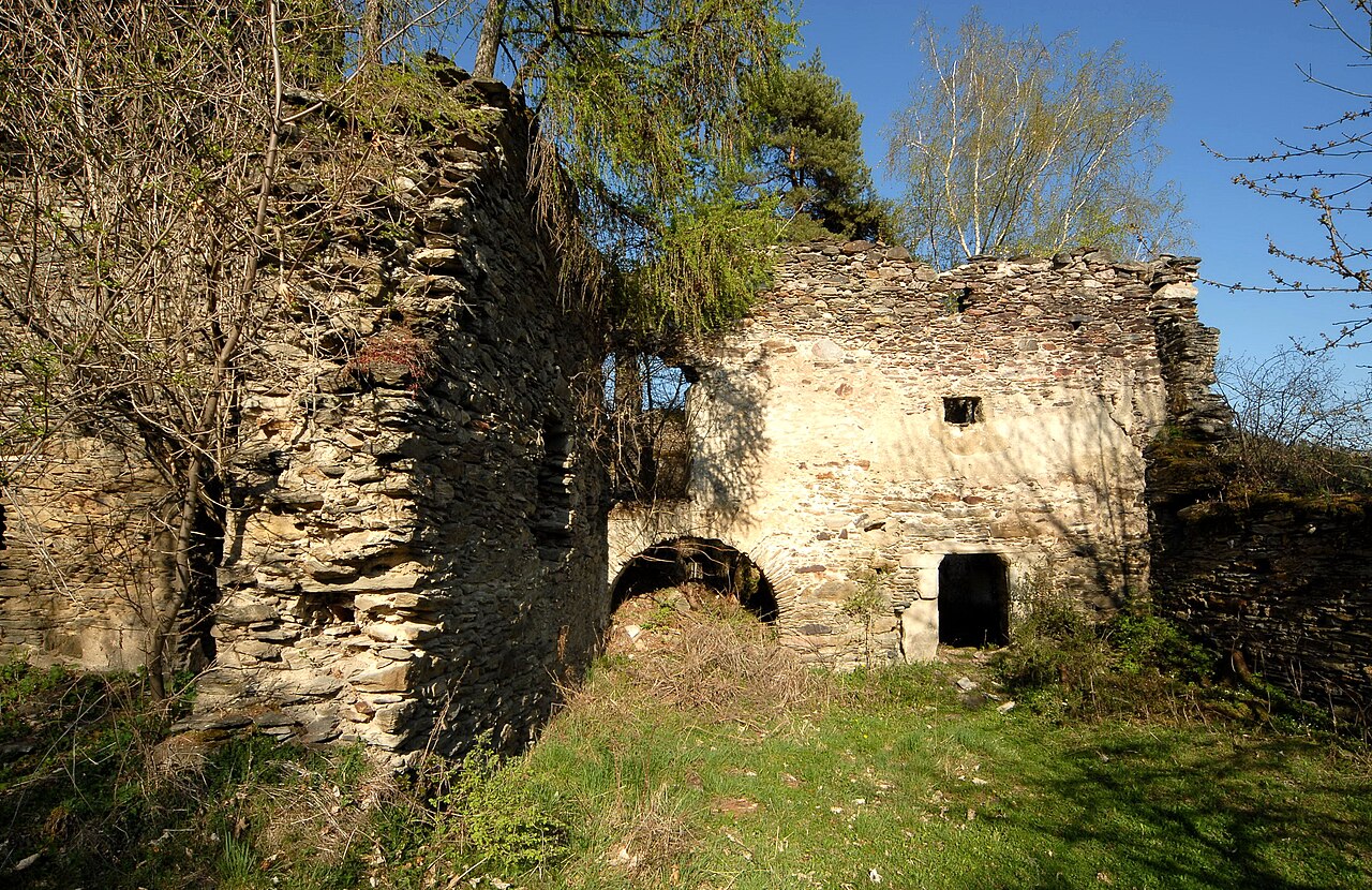
Burgruine Gradenegg is a ruined castle in the municipality of Liebenfels in Carinthia, Austria.
The small castle complex, which is in a state of decay, lies around 300 meters above Glantalboden on a low, rocky hilltop. .
The core of the complex is a massive Romanesque keep, around which some farm buildings from the 14th/15th century are grouped. To the west, separated from the economic complex, is the three-storey great hall. This building, which was part of the original construction, was extensively remodeled and extended in the 16th century and fitted with marble windows and door walls. The castle is surrounded by a ring wall from the 15th century, and in the northeast corner of this enclosure is a small corner tower. The castle was also accessed from the north side, where it is protected by a substantial moat.
The first documented reference to the castle was on 27 May 1192, attested by Rudlandus de Gradnich as Ministeriale of the Carinthian Duke. He belonged to the Lords of Gradenegg. Reinprecht von Gradenegg was the last representative of this family line to possess the estate in 1436.
The Carinthian historian Franz Xaver Kohla reports that in 1787 Roman copper and silver coins were found near or in the castle. Kohla also mentions old mines.
The castle was severely damaged by the severe earthquake in 1796 and soon afterwards was only used for stables and farm outbuildings. A drawing by the artist Markus Pernhart, which has since disappeared, shows that the castle still had all its roofs around 1870, but was already in a state of decay.
Text adapted from “Burgruine Gradenegg” on Wikipedia, CC BY-SA 4.0.
Burgruine Gradenegg ranks #7,018 of 8,134 worldwide in the atlas's castle fame ranking, and #199 of the 201 mapped in Austria. Founded 1192, it is older than 79% of the atlas's dated landmarks — one of 564 atlas entries founded in the 12th century. 18 more atlas landmarks stand within 25 km. The nearest day-trip guide is Klagenfurt am Wörthersee, 17 km away. See how Austria compares in the castle statistics.
View on the interactive castle map →Frequently asked questions
Where is Burgruine Gradenegg?
Burgruine Gradenegg stands in Austria, at 46.7633°, 14.2433°.
When was Burgruine Gradenegg built?
The atlas dates its founding to 1192. Earlier structures may have stood on the site; this is the earliest documented founding year.
How famous is Burgruine Gradenegg?
In this atlas's fame ranking: #7,018 of 8,134 worldwide, and #199 in Austria. Fame here combines how many Wikipedia language editions cover a landmark with how many people read them.
What is the nearest castle to Burgruine Gradenegg?
Burgruine Liebenfels, about 3 km away.
More castles in Austria
- Gösting Castle Austria · 11th century
- Burgruine Gurnitz Austria
- Burgruine Waisenberg Austria
- Burgruine Weidenburg Austria · 15th century
More ruins
- Burgruine Hohenwart Austria · 12th century
- Vartnov Czech Republic · 14th century
- Bossonnens Castle Switzerland · 12th century
- Cimburk Czech Republic · 14th century