 Ireland · 13th century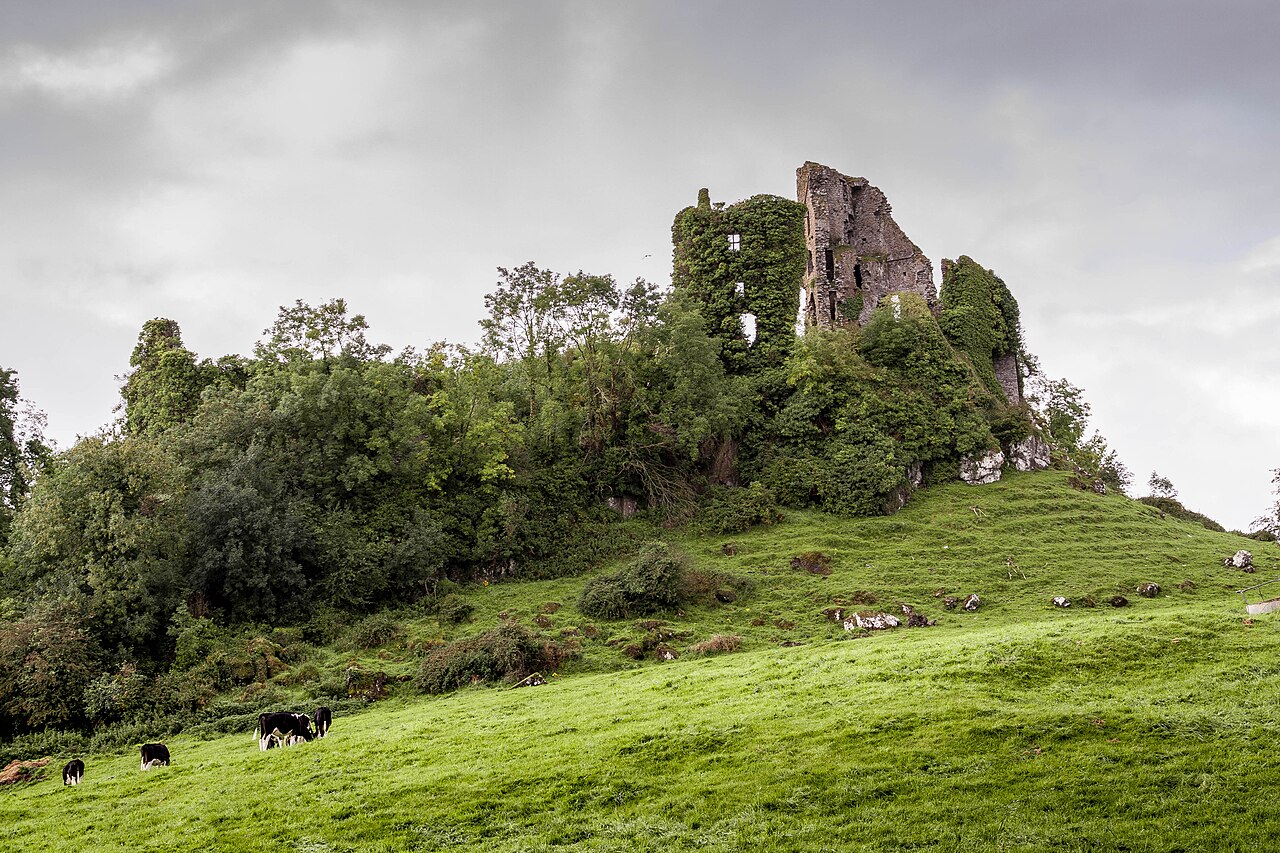
Carrigogunnell Castle (Irish: Chairrge Ó gCoinneall) is a medieval Irish fortification near the village of Clarina, on the banks of the River Shannon in County Limerick.
The structure dates to at least the early 13th century, and was slighted in September 1691 after being captured during the second siege of Limerick.
The castle is built on outcrop trap rock of volcanic origin that overlooks the low lands of County Limerick, and the River Shannon.
Westropp 1908 claimed that the plan showed little appreciation of defensive science, and as a result attributed it to the Irish Gaelic tribe of the Dalcassians. The main (southern) gateway he thought poorly defended, lacking side towers, and with walls under 5 feet (1.5 m) thick - the gate itself led to by a shallow slope. The absence of towers at the junctions of walls, and the confused plan of buildings within the defenses were taken by Westropp as evidence of the place being only a suitable as a fortified residence, and not fitted for defense of an assault or siege. The main southern gate was the only exit, excluding a sally port on the west side leading to the crags of the rock formation.
The castle had an outer ward of around 1 acre (0.40 ha) in area, approximately harp shaped in plan, with a tower in the SW corner. Much of the west wall had been removed (1908). A large two storey skewed-rectangularish building was located on the NE corner of the ward, suggested without any obvious remaining evidence to have been a chapel.
The inner (upper) ward was inset in the NW corner of the castle, with a 100 feet (30 m) range of two story buildings along the west wall, showing at least two periods of construction; there was a keep in the northwestmost corner; a range of accommodation adjacent to it to the east; and a tower and staircase on the south side. The buildings are of well-cut local limestone - and not of the rock of the outcrop.
The keep was over 50 feet (15 m) high, with 5 storeys and a spiral stair; by ca. 1908 only the outwall and parts of the southern wall remained. It shows architectural indicators dating it to the 14th of 15th centuries. To the east of the keep was a three-story residence, probably 16th century.
Text adapted from “Carrigogunnell” on Wikipedia, CC BY-SA 4.0.
Carrigogunnell ranks #7,730 of 9,079 worldwide in the atlas's castle fame ranking, and #158 of the 178 mapped in Ireland. Founded c. 1225, it is older than 73% of the atlas's dated landmarks — one of 1080 atlas entries founded in the 13th century. 7 more atlas landmarks stand within 25 km. The nearest day-trip guide is Limerick, 8 km away. See how Ireland compares in the castle statistics.
View on the interactive castle map →