 Ireland · 15th century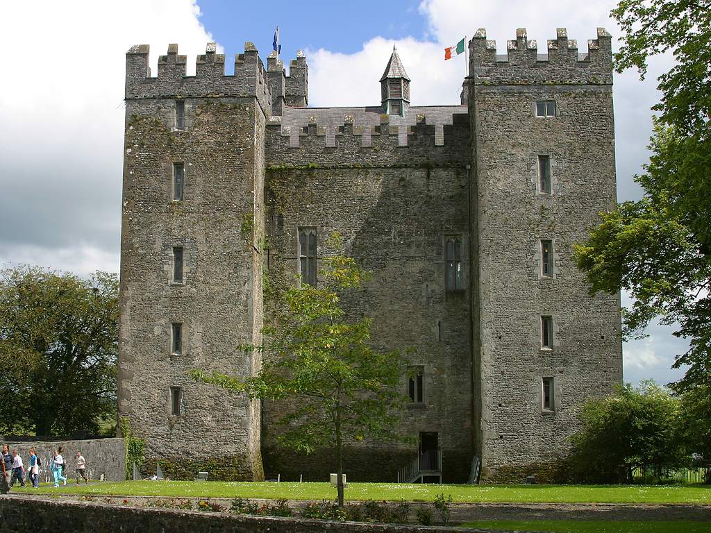
Bunratty Castle (Irish: Caisleán Bhun Raithe) is a large 15th-century tower house in County Clare, Ireland. It is located in the centre of Bunratty village, by the N18 road between Limerick and Ennis, near Shannon Town and its airport.
The name Bunratty means "mouth of the Ratty River" in Irish. This is another name for the Owenogarney River, which empties into the Shannon Estuary after flowing past the village and castle.
The first recorded settlement at the site may have been a Norse trading camp reported in the Annals of the Four Masters to have been destroyed by Brian Boru in 977. According to local tradition, such a camp was located on a rise southwest of the current castle. Since no remains of this settlement have been found, its exact location is unknown and its existence is not proven.
Around 1250, King Henry III of England granted the cantred or district of Tradraighe (or Tradree) to Robert De Muscegros, who in 1251 cut down around 200 trees in the King's wood at Cratloe. These may have been used to construct a motte and bailey castle, which would have been the first castle at Bunratty, but again the exact position of this is unknown. A later reference in the state papers, dating to 1253 gives de Muscegros the right to hold markets and an annual fair at Bunratty. It has thus been assumed that the site was the centre of early Norman control in south-eastern Clare. Early 19th-century scholars put the structure to the north-west of the current castle.
When a hotel was constructed there in 1959, John Hunt excavated the area and thought the remains to be that of a gun emplacement from the Confederate Wars (see below). This river, alongside the castle, flows into the nearby Shannon estuary.
These lands were later handed back to (or taken back by) King Henry III and granted to Thomas De Clare, a descendant of Strongbow in 1276. De Clare built the first stone structure on the site (the second castle). This castle was occupied from ca. 1278 to 1318 and consisted of a large single stone tower with lime white walls. It stood close to the river, on or near the site of the present Bunratty Castle. In the late 13th century, Bunratty had about 1,000 inhabitants. The castle was attacked several times by the O'Briens (or O'Brians) and their allies. In 1284, while De Clare was away in England, the site was captured and destroyed.
Text adapted from “Bunratty Castle” on Wikipedia, CC BY-SA 4.0.
Bunratty Castle ranks #696 of 9,079 worldwide in the atlas's castle fame ranking, and #7 of the 178 mapped in Ireland. Founded 1425, it is older than 49% of the atlas's dated landmarks — one of 554 atlas entries founded in the 15th century. Its Wikipedia articles were opened 7,032 times in the last 60 days, more than 90% of the atlas. 7 more atlas landmarks stand within 25 km. The nearest day-trip guide is Limerick, 13 km away. See how Ireland compares in the castle statistics.
View on the interactive castle map →