 Netherlands · 14th century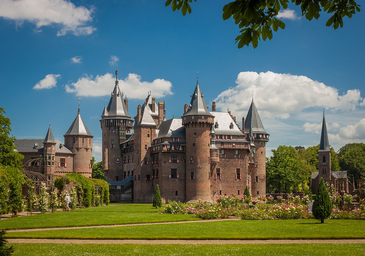
De Haar Castle (Dutch: Kasteel de Haar) is located outside Utrecht, Netherlands. It is the largest castle in The Netherlands.
The oldest historical record of a building at the location of the current castle dates to 1391. In that year, the De Haar family received the castle and the surrounding lands as a fiefdom from Hendrik van Woerden. The castle remained in the ownership of the De Haar family until 1440, when the last male heir died childless. The castle then passed to the Van Zuylen family. In 1482, the castle was burned down and the walls were destroyed, except for the parts that did not have a military function. These parts probably were incorporated into the castle when it was rebuilt during the early 16th century. The castle is mentioned in an inventory of the possessions of Steven van Zuylen from 1506, and again in a list of fiefdoms in the province Utrecht from 1536.
The oldest image of the castle dates to 1554 and shows that the castle had been largely rebuilt by then. After 1641, when Johan van Zuylen van de Haar died childless, the castle seems to have gradually fallen into ruins. The castle escaped total destruction by the French during the Rampjaar 1672.
In 1801 the last Catholic van Zuylen in the Netherlands, the bachelor Anton-Martinus van Zuylen van Nijevelt (1708–1801), bequeathed the property to his cousin Jean-Jacques van Zuylen van Nyevelt (1752–1846) of the Catholic branch in the Southern Netherlands.
In 1887, Jean-Jacques' grandson, Etienne Gustave Frédéric Baron van Zuylen van Nyevelt van de Haar (1860–1934), married Baroness Hélène de Rothschild, of the Rothschild family. When Etienne inherited the ruined castle in 1890 from his grandfather, the couple set about rebuilding the castle, fully financed by Hélène's family. For the restoration of the castle, they contracted famous architect Pierre Cuypers. He would work on this project for 20 years (from 1892 to 1912). The castle has 200 rooms and 30 bathrooms, of which only a small number on the ground and first floor have been opened to be viewed by the public. Cuypers placed a statue of himself in a corner of the gallery on the first floor.
The castle was equipped by Cuypers with the most modern gadgets, such as electrical lighting with its own generator, and central heating by way of steam. This installation is internationally recognized as an industrial monument.
Text adapted from “De Haar Castle” on Wikipedia, CC BY-SA 4.0.
Castle de Haar ranks #437 of 9,079 worldwide in the atlas's castle fame ranking, and #5 of the 199 mapped in Netherlands. Founded 1391, it is older than 52% of the atlas's dated landmarks — one of 755 atlas entries founded in the 14th century. Its Wikipedia articles were opened 20,572 times in the last 60 days, more than 97% of the atlas. 26 more atlas landmarks stand within 25 km. The nearest day-trip guide is Utrecht, 10 km away. See how Netherlands compares in the castle statistics.
View on the interactive castle map →