Castle
Château de Chouvigny
 France · 13th century
- Founded
- 1250
- Location
- Chouvigny
- Coordinates
- 46.12472°, 2.99389°
- Open data
- Wikidata Q2968949
- Links
- Wikimedia Commons
Description
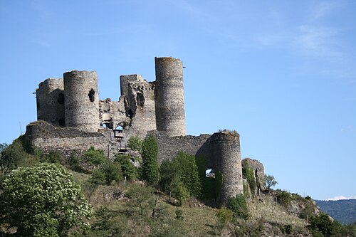
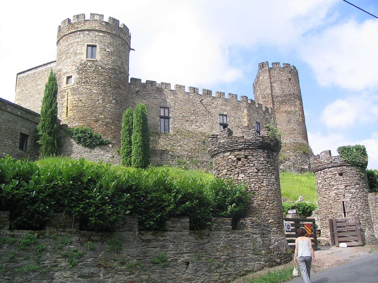
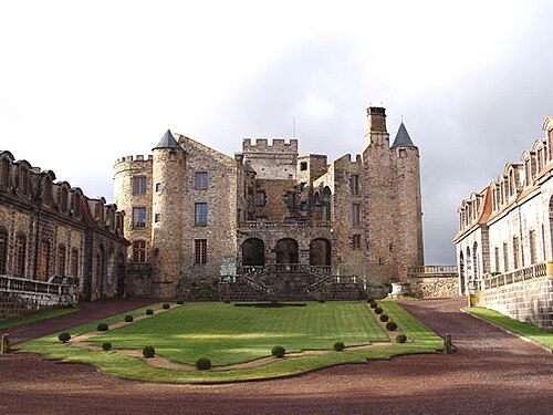
Château de Chouvigny is a castle at Chouvigny in the Sioule valley in the Allier département of France.
The castle dominates the valley of the Sioule, at a spot where the gorges, called the gorges de Chouvigny, enlarge. It is approximately 300 metres south east of the town of Chouvigny. The road which climbs from the Sioule towards the town passes behind the castle and serves as its entrance.
The castle is the cradle of the Chauvigny family which by marriage in the 13th century became Chauvigny de Blot. At the start of the 15th century, the castle passed by marriage to the Montmorin family, then, with the marriage in 1543 of Françoise de Montmorin and Jean Motier de La Fayette, lord of Hautefeuille, to the family of La Fayette. In the 17th century, it belonged to the great-grandson of Jean, François de La Fayette; his wife, Madame de La Fayette, stayed there.
Under the Second Empire, Chouvigny belonged to the duc de Morny.
The castle is privately owned. Unusually, for such a structure, it is not listed as a monument historique by the French Ministry of Culture.
Text adapted from “Château de Chouvigny” on Wikipedia, CC BY-SA 4.0.
In the rankings
Château de Chouvigny ranks #8,784 of 9,902 worldwide in the atlas's castle fame ranking, and #905 of the 954 mapped in France. Founded 1250, it is older than 67% of the atlas's dated landmarks, one of 1134 atlas entries founded in the 13th century. 4 more atlas landmarks stand within 25 km. See how France compares in the castle statistics.
Castles nearby
- Château Rocher6 km · France
- Château de Veauce6 km · France
- Château d'Effiat22 km · France
- Château de Chazeron23 km · France
More castles in France
- Château de ChâteaubriantFrance · 11th century
- Château de ComperFrance
- Château de CoursonFrance · 17th century
- Château de DomeyratFrance