 Portugal · 1st century BC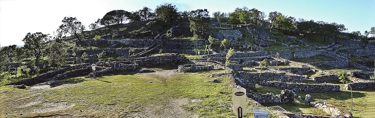
The Citânia de Briteiros is an archaeological site of the Castro culture located in the Portuguese civil parish of Briteiros São Salvador e Briteiros Santa Leocádia in the municipality of Guimarães; important for its size, "urban" form and developed architecture, it is one of the more excavated sites in northwestern Iberian Peninsula. Although primarily known as the remains of an Iron Age proto-urban hill fort (or oppidum), the excavations at the site have revealed evidence of sequential settlement, extending from the Bronze to Middle Ages.
Text adapted from “Citânia de Briteiros” on Wikipedia, CC BY-SA 4.0.
Citânia de Briteiros ranks #1,679 of 9,035 worldwide in the atlas's castle fame ranking, and #20 of the 212 mapped in Portugal. Founded 2 BC, it is older than 98% of the atlas's dated landmarks, one of 16 atlas entries founded in the 1st century BC. Its Wikipedia articles were opened 3,131 times in the last 60 days, more than 79% of the atlas. 7 more atlas landmarks stand within 25 km. The nearest day-trip guide is Braga, 9 km away. See how Portugal compares in the castle statistics.
View on the interactive castle map →