Fortress
Fort Mosta
🇲🇹 Malta · 19th century
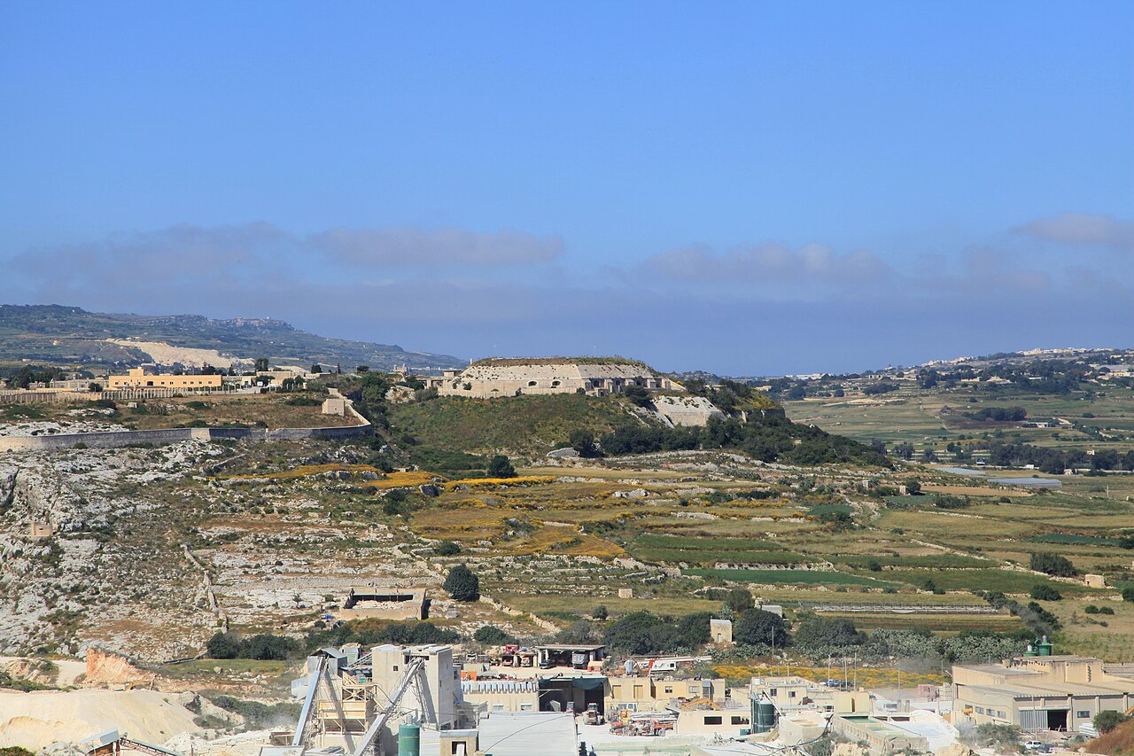
Fort Mosta (formerly written as Fort Musta, Maltese: Il-Fortizza tal-Mosta) is a polygonal fort in Mosta, Malta. It was built between 1878 and the 1880s by the British as part of the Victoria Lines. It is still in use today by the Armed Forces of Malta as an ammunition depot.
Fort Mosta was built by the British as part of the Victoria Lines, a line of fortifications along the northern part of Malta, dividing it from the more heavily populated south. It is one of three forts built along the lines, the other two being Fort Binġemma and Fort Madalena.
The fort is the most strategically placed land fort along the Victoria Lines, occupying the cliff face at the mouth of Wied il-Għasel. According to Giorgio Grognet de Vassé, the site has had strategic value since ancient times and it was previously occupied by a Bronze Age citadel and village, and there were archaeological remains there. When the British requisitioned the site to build the fort, they probably destroyed the Bronze Age remains, although no proof of their existence is known. Despite this, catacombs dating to the 4th or 5th century AD were found under the fort and they still exist.
The fort was last of the three major forts of the Victoria Lines to be built. Its construction was approved in 1873, but while construction the other forts began in 1875 (Fort Binġemma) or 1878 (Fort Madalena), work on Fort Mosta had not commenced by the February 1878 visit of General Lintorn Simmons (who became Governor of Malta in 1884). Construction began soon after his visit.
The fort consists of two parts, a pentagonal keep, which is surrounded by a ditch, and a battery outside the keep. These were linked together with a sally port. Unlike the two other forts, Fort Mosta did not have RML guns since it was not intended for coastal defence. It was initially armed with 64-pounder smooth-bore muzzle loading guns, but later 6-inch breech-loading guns were installed.
The Victoria Lines were abandoned in 1907, just eight years after they were completed, as they were deemed to be of dubious defensive value. Although Fort Binġemma and Fort Madalena remained in use for coastal defence, Fort Mosta lost most of its military value. By 1940 it became an ammunition depot.
Fort Mosta is still used as an ammunition depot by the Armed Forces of Malta.
Text adapted from “Fort Mosta” on Wikipedia, CC BY-SA 4.0.
Fort Mosta ranks #5,732 of 8,134 worldwide in the atlas's castle fame ranking, and #25 of the 29 mapped in Malta. Founded 1878, it is older than 5% of the atlas's dated landmarks — one of 607 atlas entries founded in the 19th century. 27 more atlas landmarks stand within 25 km. See how Malta compares in the castle statistics.
View on the interactive castle map →Frequently asked questions
Where is Fort Mosta?
Fort Mosta stands in Malta, at 35.92264°, 14.42614°.
When was Fort Mosta built?
The atlas dates its founding to 1878. Earlier structures may have stood on the site; this is the earliest documented founding year.
How famous is Fort Mosta?
In this atlas's fame ranking: #5,732 of 8,134 worldwide, and #25 in Malta. Fame here combines how many Wikipedia language editions cover a landmark with how many people read them.
What is the nearest castle to Fort Mosta?
Fort Madalena, about 3 km away.
More castles in Malta
- Mamo Tower Malta · 17th century
- Fort Leonardo Malta · 19th century
- Fort Binġemma Malta · 19th century
- Palazzo Parisio (Valletta) Malta · 18th century
More fortresses
- Fort Nieuw-Amsterdam Suriname · 18th century
- Mirabella Fortress Croatia · 13th century
- Fortress Kostajnica Croatia · 14th century
- Kot Diji Fort Pakistan · 18th century