 Portugal · 12th century
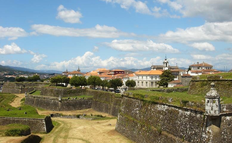
Fortificações da Praça de Valença do Minho ranks #4,860 of 9,040 worldwide in the atlas's castle fame ranking, and #69 of the 212 mapped in Portugal. Founded c. 1200, it is older than 75% of the atlas's dated landmarks, one of 763 atlas entries founded in the 12th century. Its Wikipedia articles were opened 1,622 times in the last 60 days, more than 64% of the atlas. 10 more atlas landmarks stand within 25 km. The nearest day-trip guide is Viana do Castelo, 40 km away. See how Portugal compares in the castle statistics.
The Fortificações da Praça de Valença do Minho (in Portuguese: Praça-forte de Valença, or Fortificações da Praça de Valença do Minho) is a fortification situated in the freguesia of Valença, Cristelo Covo e Arão, in the municipality of Valença (Viana do Castelo District, Portugal).
The fortification of Valença, a town on the left bank of the Minho, on the Portuguese border with Galicia, dates back to the turn of the 12th and 13th centuries. Its purpose was to defend the town and the crossing of this stretch of the river. It has been classified as a National Monument since 1928.
Machine-translated from “Place forte de Valença” on the French Wikipedia, CC BY-SA 4.0.
View on the interactive castle map →