Fortress
Fort of São Teodósio da Ponta do Cavalo
🇵🇹 Portugal · 17th century
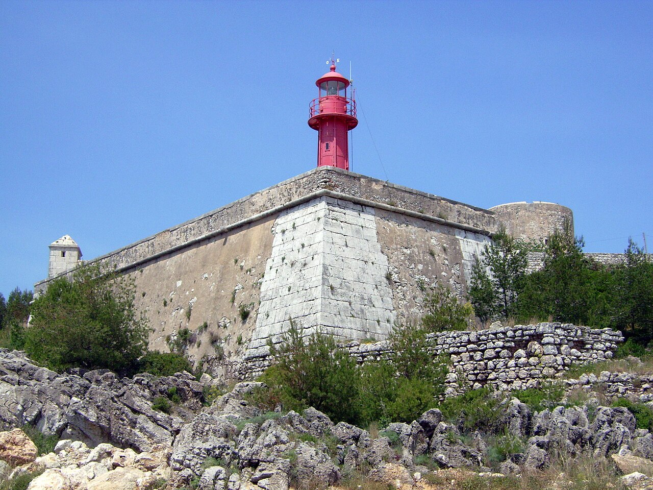
The Fort of São Teodósio da Ponta do Cavalo is a coastal fort located in a dominant position at the extreme west of the Bay of Sesimbra in the Setúbal District of Portugal. It was built between 1648 and 1652.
During the period of the Portuguese Restoration War (1640-68), King John IV undertook a project to modernize the coastal defences of the country. This included the remodelling of existing fortresses and reinforcing their firepower, together with the construction of new fortresses located in strategic positions. The Fort of São Teodósio was part of the defensive line of the stretch of coast, known today as the Costa Azul (Blue Coast), stretching from Albarquel to Sesimbra, which was designed to assist with the defence of the important maritime settlement of Setúbal.
The fort was named in honour of the Crown Prince, Dom Teodósio, Prince of Brazil. It was executed by the military engineer Sebastião Pereira de Frias. Built in the Mannerist style from stone and brick, it has an irregular polygonal plan, with two square bastions and a circular tower in the centre.
The fortification was badly damaged by the earthquake in 1755 but never lost its strategic importance. In the 19th century it was garrisoned at the time of the Peninsular War, during the first French invasion led by General Junot (1807-08). Abandoned by troops in 1822, it was again used during the Liberal Wars (1828-34), but fell into disrepair thereafter. In 1895 a lighthouse was installed inside the fort.
In the twentieth century, the original layout of the fort was altered to accommodate construction of a harbour and its access road. It is now occupied by the Portuguese Navy, which is also responsible for managing the lighthouse. Visits are not possible.
Text adapted from “Fort of São Teodósio da Ponta do Cavalo” on Wikipedia, CC BY-SA 4.0.
Fort of São Teodósio da Ponta do Cavalo ranks #7,219 of 8,134 worldwide in the atlas's castle fame ranking, and #178 of the 205 mapped in Portugal. Founded 1652, it is older than 26% of the atlas's dated landmarks — one of 626 atlas entries founded in the 17th century. 7 more atlas landmarks stand within 25 km. The nearest day-trip guide is Lisbon, 30 km away. See how Portugal compares in the castle statistics.
View on the interactive castle map →Frequently asked questions
Where is Fort of São Teodósio da Ponta do Cavalo?
Fort of São Teodósio da Ponta do Cavalo stands in Portugal, at 38.43472°, -9.11667°.
When was Fort of São Teodósio da Ponta do Cavalo built?
The atlas dates its founding to 1652. Earlier structures may have stood on the site; this is the earliest documented founding year.
How famous is Fort of São Teodósio da Ponta do Cavalo?
In this atlas's fame ranking: #7,219 of 8,134 worldwide, and #178 in Portugal. Fame here combines how many Wikipedia language editions cover a landmark with how many people read them.
What is the nearest castle to Fort of São Teodósio da Ponta do Cavalo?
Fortress of Saint James of Sesimbra, about 2 km away.
More castles in Portugal
- Fortificações da Praça de Valença do Minho Portugal
- Fort of São João do Arade Portugal · 16th century
- Castle of Vila Nova de Cerveira Portugal
- Castle of Alcantarilha Portugal
More fortresses
- Borj Masouda Tunisia
- Borj Ennar Tunisia
- Forte do Castelo de Belém Brazil · 17th century
- Thirumayam Fort India · 17th century