 Algeria · 2nd century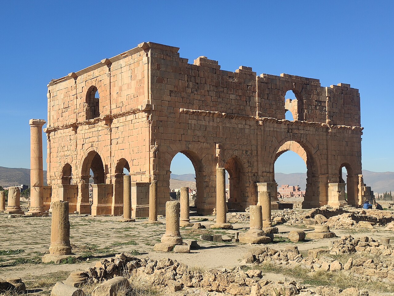
Lambaesis (Lambæsis), Lambaisis or Lambaesa (Lambèse in colonial French), is a Roman archaeological site in Algeria, 11 km (7 mi) southeast of Batna and 27 km (17 mi) west of Timgad, located next to the modern village of Tazoult. The former bishopric is also a Latin Catholic titular bishopric.
Lambaesa was founded by the Roman military. The camp of the third legion (Legio III Augusta), to which it owes its origin, appears to have been established between AD 123–129, in the time of Roman emperor Hadrian, whose address to his soldiers was found inscribed on a pillar in a second camp to the west of the great camp still extant. However, other evidence suggests it was formed during the Punic Wars.
The town is built 622 m above sea level in the plain and on the spurs of the Djebel Asker By AD 166 mention is made of the decurions of a vicus, 10 curiae of which are known by name; and the vicus became a municipium probably at the time when it was made the capital of the newly founded province of Numidia. Lambaesis was populated mainly by Romanized Berbers and by some Roman colonists with their descendants: Latin was the official and commonly used language (even if local Berbers spoke their own language mixed with Latinisms).
III Augusta was disbanded by Gordian III and the legionaries dispersed among the North African provinces. But the legion was restored in the AD 250s by Valerianus and Gallienus and from then on the legion was known as Augusta Restituta. Its final departure did not take place until after AD 392 (the town soon afterwards declined).
Indeed, under Septimius Severus (AD 193), Numidia was separated from Africa Vetus, and governed by an imperial procurator. Under the new organization of the empire by Diocletian, Numidia was divided in two provinces: the north became Numidia Cirtensis, with capital at Cirta, while the south, which included the Aurès Mountains and was threatened by raids, became Numidia Militiana, "Military Numidia", with capital at the legionary base of Lambaesis.
Subsequently, however, Emperor Constantine the Great reunited the two provinces in a single one, administered from Cirta, which was now renamed Constantina (modern Constantine, Algeria) in his honour.
Text adapted from “Lambaesis” on Wikipedia, CC BY-SA 4.0.
Lambaesis ranks #1,299 of 9,035 worldwide in the atlas's castle fame ranking, and #3 of the 24 mapped in Algeria. Founded 123, it is older than 98% of the atlas's dated landmarks, one of 22 atlas entries founded in the 2nd century. Its Wikipedia articles were opened 2,659 times in the last 60 days, more than 75% of the atlas. 1 more atlas landmarks stand within 25 km. See how Algeria compares in the castle statistics.
View on the interactive castle map →