Ruin
Petavonium
🇪🇸 Spain
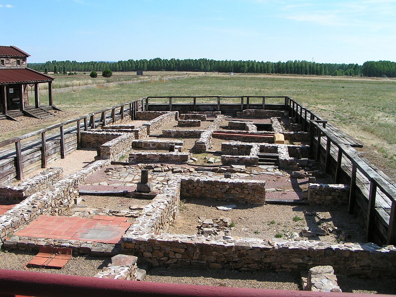
Petavonium was a Roman Legionary Fortress (castrum) of the Legio X Gemina, and later a Roman city formed from the canabae, or civilian camp. It was located in the valley of Vidriales in an area of the modern Santibanez de Vidriales and its hamlet Rosinos de Vidriales, in the province of Zamora (Castilla y Leon).
The legion was located here during the war against the Astures and Cantabrians to control the routes that connected this area with Gallaecia and with the rest of the valley of Douro and Lusitania, including those used for transportation of gold from the mines of Las Médulas o Cavenes.
The archaeological evidence shows a camp of about 20 ha, many ceramic remains, coins, remains of weapons and other metal objects, and building materials stamped with the legion's motif.
The departure of the legion in 63 AD must have been a setback for the town but it began to recover in the Flavian dynasty, probably under Domitian, when Ala II Flavia Hispanorum Civium Romanorum was stationed in the old barracks of X Gemina. The new fort, a castellum alae, was a rectangular walled enclosure of about 4 ha built inside the former camp.
Around this camp emerged a vicus, or town, of about 80 ha. The legion's presence attracted large numbers of people, Hispanics and Italians, who created a dense network of rural settlements in the Vidriales valley and which became the future city of Petavonium. In the 2nd and 3rd centuries AD it became one of the largest cities in Asturian territory.
Text adapted from “Petavonium” on Wikipedia, CC BY-SA 4.0.
Petavonium ranks #6,636 of 8,134 worldwide in the atlas's castle fame ranking, and #376 of the 602 mapped in Spain. See how Spain compares in the castle statistics.
View on the interactive castle map →Frequently asked questions
Where is Petavonium?
Petavonium stands in Spain, at 42.08894°, -5.99797°.
How famous is Petavonium?
In this atlas's fame ranking: #6,636 of 8,134 worldwide, and #376 in Spain. Fame here combines how many Wikipedia language editions cover a landmark with how many people read them.
What is the nearest castle to Petavonium?
Palacio Episcopal de Astorga, about 41 km away.
More castles in Spain
- Torre Ladrones Spain
- Castillo de las Coloradas Spain
- Torre Nueva Spain
- Sant Nicolau Castle Spain · 17th century
More ruins
- Roman walls of Barcelona Spain · 3rd century
- Castro of Burela Spain
- Burt Castle Ireland
- Qasr Usaykhim Jordan · 1st century