Ruïne
Petavonium
🇪🇸 Spanje
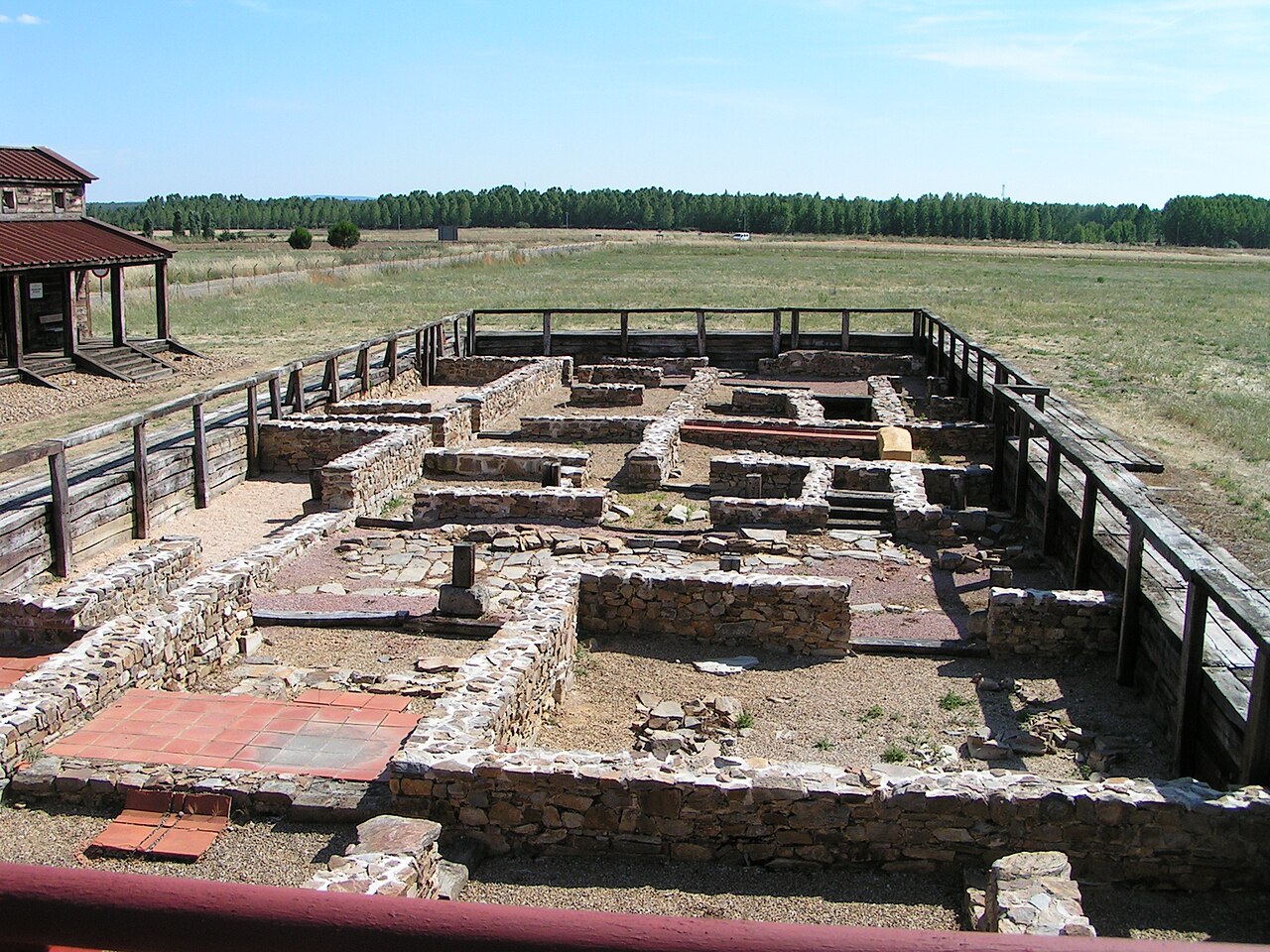
Petavonium was een Romeins legioensfort (castrum) van het Legio X Gemina, en later een Romeinse stad, ontstaan uit de canabae, oftewel het burgerlijke kamp. Het lag in de vallei van Vidriales, in een gebied van het huidige Santibáñez de Vidriales en het gehucht Rosinos de Vidriales, in de provincie Zamora (Castilië en León).
Het legioen bevond zich hier tijdens de oorlog tegen de Asturiërs en Cantabriërs, om de routes te beheersen die dit gebied verbonden met Gallaecia en de rest van de Duerovallei en Lusitanië, waaronder de routes die werden gebruikt voor het transport van goud uit de mijnen van Las Médulas of Cavenes.
Het archeologische bewijsmateriaal toont een kamp van ongeveer 20 ha, met veel keramische resten, munten, wapenresten en andere metalen voorwerpen, en bouwmaterialen gestempeld met het motief van het legioen.
Het vertrek van het legioen in 63 n.Chr. moet een tegenslag zijn geweest voor de stad, maar deze begon te herstellen tijdens de Flavische dynastie, waarschijnlijk onder Domitianus, toen de Ala II Flavia Hispanorum Civium Romanorum in de oude kazernes van X Gemina werd gelegerd. Het nieuwe fort, een castellum alae, was een rechthoekige ommuurde ruimte van ongeveer 4 ha, gebouwd binnen het voormalige kamp.
Rond dit kamp ontstond een vicus, oftewel stad, van ongeveer 80 ha. De aanwezigheid van het legioen trok grote aantallen mensen aan, zowel Hispaniërs als Italianen, die in de Vidriales-vallei een dicht netwerk van landelijke nederzettingen vormden, wat uitgroeide tot de latere stad Petavonium. In de 2e en 3e eeuw na Christus werd het een van de grootste steden in Asturisch gebied.
Bewaard gebleven zijn de poorten, met name de dubbele praetoria-poorten, van de principia, oftewel het hoofdkwartier, en van het valetudinarium, oftewel het hospitaal.
Machinaal vertaald uit “Petavonium” op de Engelstalige Wikipedia, CC BY-SA 4.0.
Petavonium staat op plaats 6.636 van 8.134 in de bekendheidsranglijst van deze atlas en op plaats 376 van de 602 die de atlas in Spanje in kaart brengt. Zie hoe dat zich verhoudt in de kastelenstatistiek.
Bekijk op de interactieve kastelenkaart →Veelgestelde vragen
Waar ligt Petavonium?
Petavonium ligt in Spanje, op 42.08894°, -5.99797°.
Hoe bekend is Petavonium?
In de bekendheidsranglijst van deze atlas: plaats 6.636 van 8.134 wereldwijd, plaats 376 in Spanje. Bekendheid combineert het aantal Wikipedia-taalversies met het aantal lezers.
Welk kasteel ligt het dichtst bij Petavonium?
Het Bisschoppelijk Paleis van Astorga, ongeveer 41 km verderop.
Meer kastelen in Spanje
- Torre Ladrones Spanje
- Castillo de las Coloradas Spanje
- Torre Nueva Spanje
- Sant Nicolau Castle Spanje · 17e eeuw
Meer ruïnes
- Roman walls of Barcelona Spanje · 3e eeuw
- Castro of Burela Spanje
- Burt Castle Ierland
- Qasr Usaykhim Jordanië · 1e eeuw