Burg
Landsfort Herle
🇳🇱 Niederlande · 13. Jahrhundert
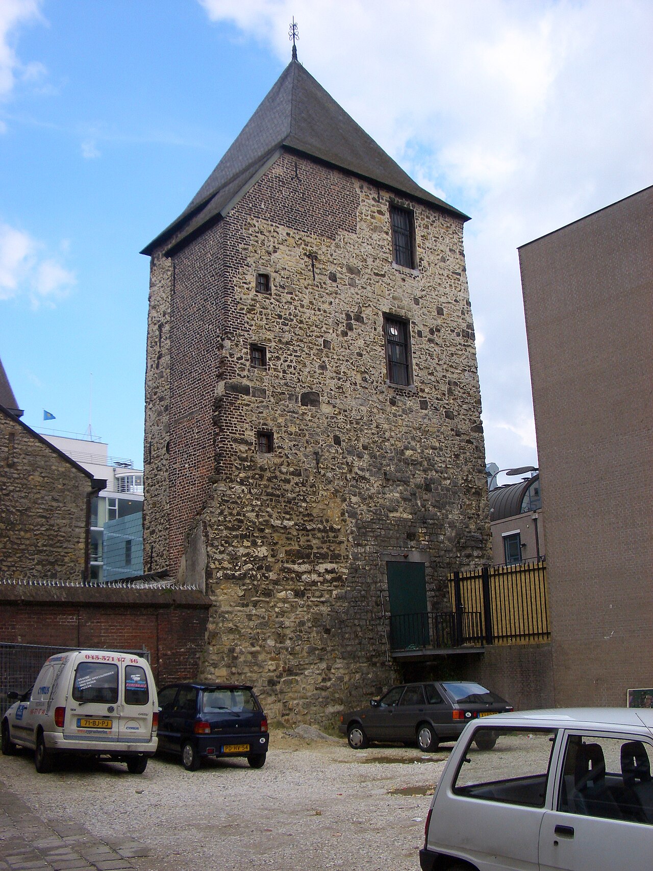
Landsfort Herle war eine befestigte Anlage mit Graben im Zentrum von Heerlen, Niederlande (ungefähr der heutige Pancratiusplein). Sie wurde wahrscheinlich von den Grafen von Are-Hochstaden (auch Heren van Are genannt) erbaut. Der Name Landsfort („Festung des Landes“) wurde im 19. Jahrhundert eingeführt, basierend auf der Tatsache, dass die Befestigung in die Zuständigkeit des Landes fiel. Das Fort lässt sich genauer als sogenannte Wehrkirche (deutsch: Kirchenburg) einordnen; eine (befestigte) Kirche, umgeben von einer Ringmauer. Landsfort Herle scheint die einzige Kirchenburg in den Niederlanden zu sein (nicht zu verwechseln mit Wehrkirchen, die zahlreicher vorkommen, aber keine Ringmauer besitzen). Im 13. Jahrhundert gelangten Heerlen und das Landsfort Herle in den Besitz der Herzöge von Brabant. Das Landsfort wurde 1244 von den Herzögen von Brabant (wieder)aufgebaut.
Die Ringmauer gilt als eine der ältesten noch erkennbaren in den Niederlanden; ein Teil davon wurde ausgegraben.
Ein Modell der Festung wurde anhand einer Karte von 1787 erstellt, die während umfangreicher Restaurierungsarbeiten an der Pancratiuskerk in den 1960er-Jahren gefunden wurde. Das Fort besaß drei Tore und zwei Türme: den Glockenturm der Kirche und den Schelmentoren, beide mit 2 Meter dicken Mauern.
Im Dachgebälk der Kirche wurden kleine Räume eingebaut, um den Bewohnern von Heerlen während Kampfhandlungen Schutz zu bieten. Diese Räume wurden leider zerstört, als in der Silvesternacht 1944/1945 vermutlich eine deutsche Bombe die Kirche traf.
Maschinell übersetzt aus „Landsfort Herle“ in der englischsprachigen Wikipedia, CC BY-SA 4.0.
Landsfort Herle steht weltweit auf Platz 6.890 von 8.134 im Burgen-Bekanntheitsranking des Atlas und Nr. 134 der 201 in den Niederlanden verzeichneten. Die Gründung fällt auf 1244 — früher als bei 73% der datierten Objekte des Atlas — eines von 861 Atlas-Objekten, die im 13. Jahrhundert gegründet wurden. Im Umkreis von 25 km stehen 41 weitere Objekte des Atlas. Der nächste Ausflugs-Guide ist Aachen, 14 km entfernt. Sehen Sie in der Burgen-Statistik, wie die Niederlande abschneiden.
Auf der interaktiven Burgenkarte ansehen →Häufige Fragen
Wo liegt Landsfort Herle?
Landsfort Herle liegt in den Niederlanden, bei 50.88778°, 5.98028°.
Wann wurde Landsfort Herle erbaut?
Der Atlas nennt als Gründungsjahr 1244. Frühere Anlagen mögen an dieser Stelle bestanden haben; dies ist das älteste dokumentierte Gründungsjahr.
Wie bekannt ist Landsfort Herle?
Im Bekanntheitsranking dieses Atlas: Platz 6.890 von 8.134 weltweit, Platz 134 in den Niederlanden. Bekanntheit misst hier, in wie vielen Wikipedia-Sprachversionen ein Denkmal steht und wie oft diese gelesen werden.
Welche Burg liegt in der Nähe von Landsfort Herle?
Das Schloss Schaesberg, rund 2 km entfernt.
Weitere Burgen in den Niederlanden
- Polanen Castle Niederlande · 13. Jahrhundert
- Overvoorde Niederlande · 17. Jahrhundert
- Fort Amsterdam (Sint Eustatius) Niederlande · 18. Jahrhundert
- Ellewoutsdijk Fort Niederlande
Weitere Burgen
- Cemilli-Burg Türkei
- Mehrnegar Castle Iran
- Sinap Castle Türkei
- Ardanuç-Burg Türkei · 5. Jahrhundert