Castle
Landsfort Herle
🇳🇱 Netherlands · 13th century
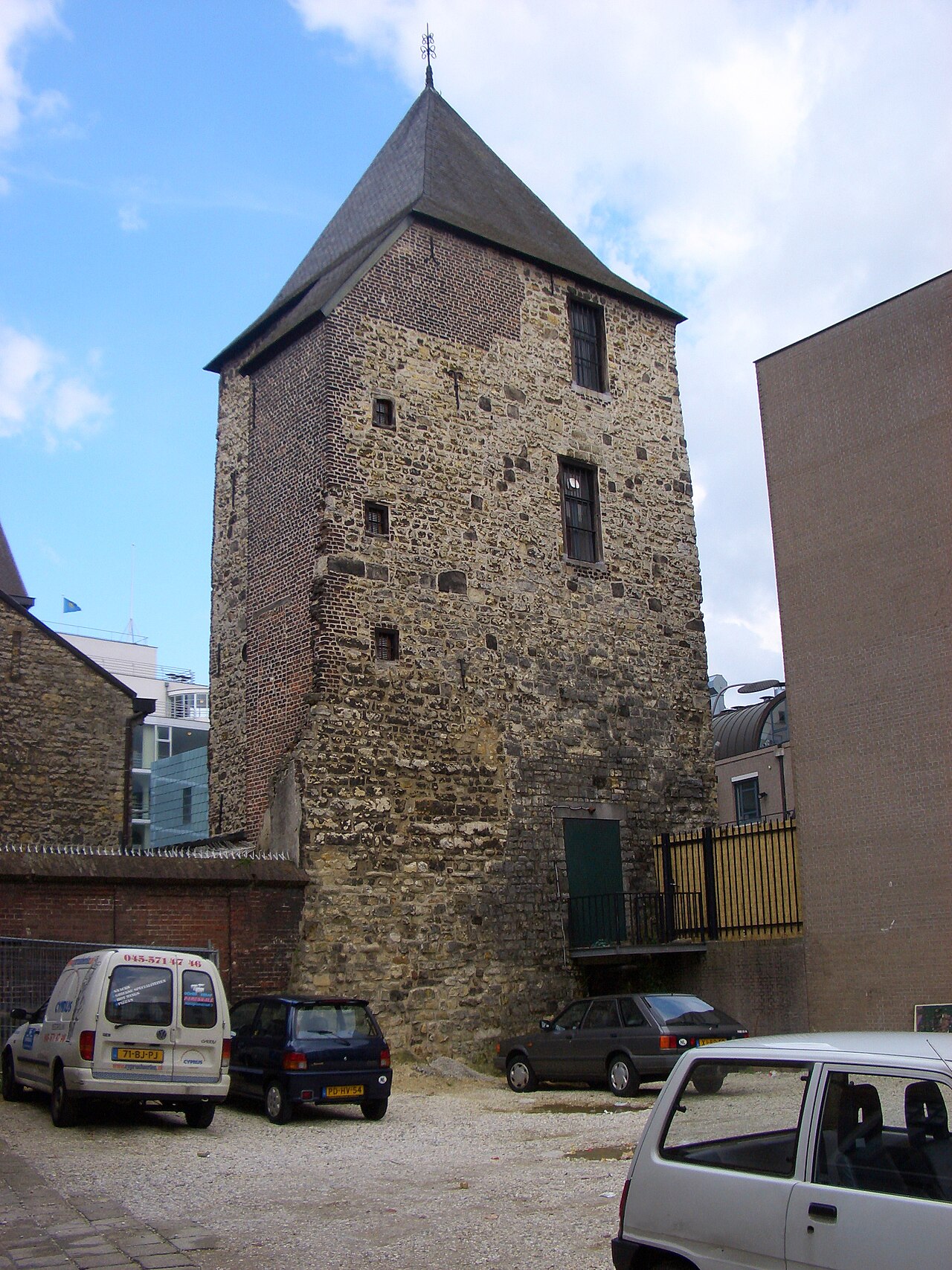
Landsfort Herle was a fortification with a moat in the centre of Heerlen, Netherlands (roughly the current Pancratiusplein). It was probably built by the counts of Ahr-Hochstaden (also referred to as Heren van Are) The name Landsfort (‘fort of the land’) was introduced in the 19th century, based on the fact that the fortification falls under the responsibility of the land. The fort can more accurately be classified as a so called fortress church (German: Kirchenburg); a (fortified) church surrounded by a curtain wall. Landsfort Herle appears to be the only Kirchenburg in the Netherlands (not to be confused with Wehrkirchen or fortified churches, which are more numerous, but lack the curtain wall). In the 13th century Heerlen and landsfort Herle, came into the possession of the Dukes of Brabant. The Landsfort was (re)built by the Dukes of Brabant in 1244.
The curtain wall is believed to be one of the oldest still recognisable in the Netherlands, part of it has been excavated.
A model of the fort was constructed based on a map from 1787, which was found during extensive restorations to the Pancratiuskerk in the 1960s. The fort had three gates and two towers; the belfry of the church and the Schelmentoren, both with 2 metre thick walls.
Small rooms were built into the rafters of the church, to provide shelter for the inhabitants of Heerlen during hostilities. Unfortunately these rooms were destroyed when a supposedly German bomb strucik the church on New Year's Eve 1944/1945.
Text adapted from “Landsfort Herle” on Wikipedia, CC BY-SA 4.0.
Landsfort Herle ranks #6,890 of 8,134 worldwide in the atlas's castle fame ranking, and #134 of the 201 mapped in Netherlands. Founded 1244, it is older than 73% of the atlas's dated landmarks — one of 861 atlas entries founded in the 13th century. 41 more atlas landmarks stand within 25 km. The nearest day-trip guide is Aachen, 14 km away. See how Netherlands compares in the castle statistics.
View on the interactive castle map →Frequently asked questions
Where is Landsfort Herle?
Landsfort Herle stands in the Netherlands, at 50.88778°, 5.98028°.
When was Landsfort Herle built?
The atlas dates its founding to 1244. Earlier structures may have stood on the site; this is the earliest documented founding year.
How famous is Landsfort Herle?
In this atlas's fame ranking: #6,890 of 8,134 worldwide, and #134 in the Netherlands. Fame here combines how many Wikipedia language editions cover a landmark with how many people read them.
What is the nearest castle to Landsfort Herle?
Schaesberg Castle, about 2 km away.
More castles in the Netherlands
- Polanen Castle Netherlands · 13th century
- Huis Overvoorde, Rijswijk Netherlands · 17th century
- Fort Amsterdam (Sint Eustatius) Netherlands · 18th century
- Ellewoutsdijk Fort Netherlands
More castles
- Cemilli Castle Turkey
- Mehrnegar Castle Iran
- Sinap Castle Turkey
- Ardanuç Castle Turkey · 5th century