Castillo
Landsfort Herle
🇳🇱 Países Bajos · siglo XIII
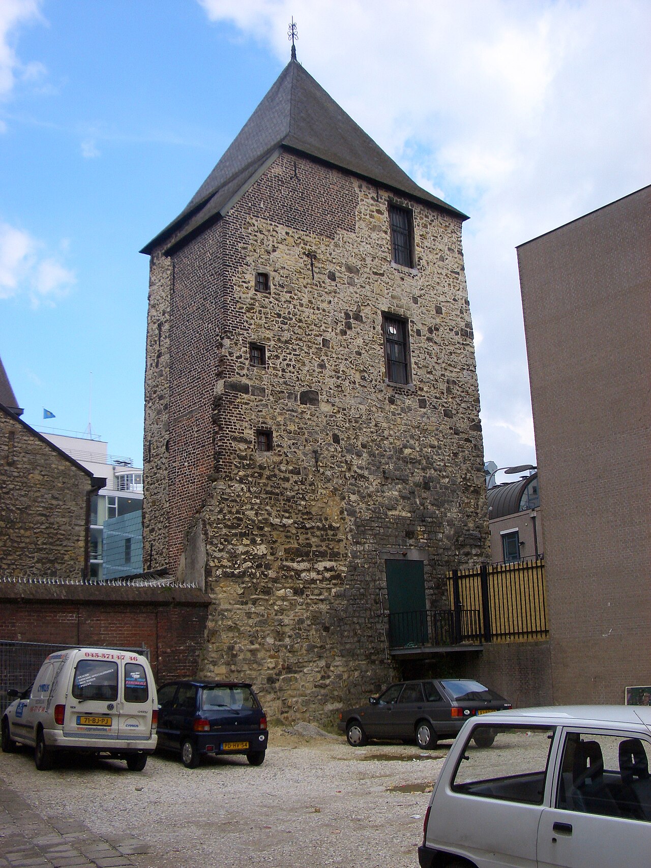
El Landsfort Herle era una fortificación con foso en el centro de Heerlen, Países Bajos (aproximadamente en la actual Pancratiusplein). Probablemente fue construida por los condes de Ahr-Hochstaden (también llamados Heren van Are). El nombre Landsfort («fuerte de la tierra») se introdujo en el siglo XIX, basándose en el hecho de que la fortificación quedaba bajo la responsabilidad del territorio (land). El fuerte puede clasificarse con mayor precisión como una llamada iglesia fortaleza (en alemán: Kirchenburg), es decir, una iglesia (fortificada) rodeada por una muralla cortina. El Landsfort Herle parece ser la única Kirchenburg de los Países Bajos (que no debe confundirse con las Wehrkirchen o iglesias fortificadas, más numerosas, pero carentes de muralla cortina). En el siglo XIII, Heerlen y el landsfort Herle pasaron a manos de los duques de Brabante. El Landsfort fue (re)construido por los duques de Brabante en 1244.
Se cree que la muralla cortina es una de las más antiguas aún reconocibles de los Países Bajos; parte de ella ha sido excavada.
Se construyó una maqueta del fuerte basada en un mapa de 1787, hallado durante amplias restauraciones de la Pancratiuskerk en los años sesenta. El fuerte tenía tres puertas y dos torres: el campanario de la iglesia y el Schelmentoren, ambos con muros de 2 metros de grosor.
Se construyeron pequeñas habitaciones en las vigas del tejado de la iglesia para dar refugio a los habitantes de Heerlen durante las hostilidades. Lamentablemente, estas habitaciones fueron destruidas cuando una supuesta bomba alemana alcanzó la iglesia en Nochevieja de 1944-1945.
Traducción automática de «Landsfort Herle» en la Wikipedia en inglés, CC BY-SA 4.0.
Landsfort Herle ocupa el puesto 6890 de 8134 en el mundo en la clasificación de fama de este atlas y el n.º 134 de los 201 que el atlas cartografía en los Países Bajos. Su fundación, en 1244, es anterior a la del 73% de los monumentos datados del atlas — uno de los 861 monumentos del atlas fundados en el siglo XIII. En 25 km a la redonda hay otros 41 monumentos del atlas. La guía de excursión más cercana es Aquisgrán, a 14 km. Compara el dato en las estadísticas de castillos.
Ver en el mapa interactivo de castillos →Preguntas frecuentes
¿Dónde está Landsfort Herle?
El castillo se encuentra en los Países Bajos, en las coordenadas 50.88778°, 5.98028°.
¿De qué año data Landsfort Herle?
El atlas fija su fundación en 1244. Pudieron existir construcciones anteriores en el mismo lugar; este es el año documentado más antiguo.
¿Qué puesto ocupa Landsfort Herle en la clasificación por fama?
En la clasificación por fama de este atlas: n.º 6890 de 8134 en el mundo, y n.º 134 en los Países Bajos. La fama combina en cuántas ediciones de Wikipedia aparece un monumento y cuánta gente las lee.
¿Qué castillo está más cerca de Landsfort Herle?
Schaesberg Castle, a unos 2 km.
Más castillos en los Países Bajos
- Polanen Castle Países Bajos · siglo XIII
- Huis Overvoorde, Rijswijk Países Bajos · siglo XVII
- Fort Amsterdam (Sint Eustatius) Países Bajos · siglo XVIII
- Ellewoutsdijk Fort Países Bajos
Más castillos
- Cemilli Castle Turquía
- Mehrnegar Castle Irán
- Sinap Castle Turquía
- Ardanuç Castle Turquía · siglo V