Fortaleza
Caherconree
🇮🇪 Irlanda
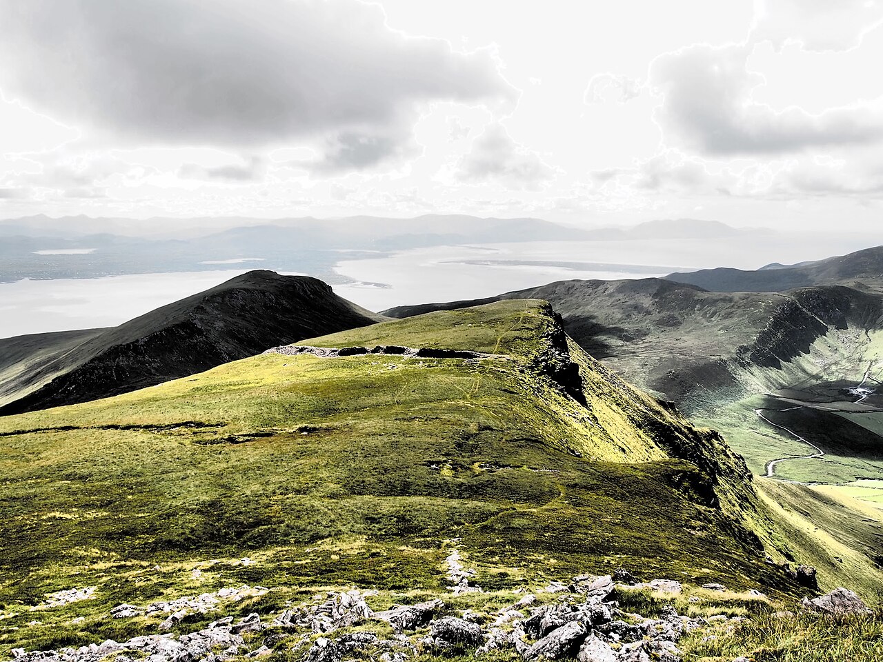
Caherconree (irlandés: Cathair Conraoi, que significa 'fuerte de piedra de Cú Roí') es, con 835 metros (2740 pies), el vigésimo pico más alto de Irlanda según la escala Arderin y el vigesimoséptimo según la escala Vandeleur-Lynam. Caherconree es la segunda montaña más alta de las Slieve Mish Mountains, en la península de Dingle, condado de Kerry, Irlanda, y en una de sus estribaciones meridionales se encuentra un antiguo fuerte de promontorio de piedra, protegido como Monumento Nacional.
Traducción automática de «Caherconree» en la Wikipedia en inglés, CC BY-SA 4.0.
Caherconree ocupa el puesto 3472 de 8134 en el mundo en la clasificación de fama de este atlas y el n.º 49 de los 173 que el atlas cartografía en Irlanda. En 25 km a la redonda hay otros 1 monumentos del atlas. La guía de excursión más cercana es Limerick, a 99 km. Compara el dato en las estadísticas de castillos.
Ver en el mapa interactivo de castillos →Preguntas frecuentes
¿Dónde está Caherconree?
La fortaleza se encuentra en Irlanda, en las coordenadas 52.19722°, -9.86278°.
¿Qué puesto ocupa Caherconree en la clasificación por fama?
En la clasificación por fama de este atlas: n.º 3472 de 8134 en el mundo, y n.º 49 en Irlanda. La fama combina en cuántas ediciones de Wikipedia aparece un monumento y cuánta gente las lee.
¿Qué castillo está más cerca de Caherconree?
Ballymalis Castle, a unos 17 km.
Más castillos en Irlanda
- Dromoland Castle Irlanda · siglo XIX
- Castillo de Portumna Irlanda · siglo XVII
- Castle Leslie Irlanda · siglo XIX
- Castillo de Ormonde Irlanda · siglo XIV
Más fortalezas
- Fort Crèvecœur Ghana · siglo XVII
- Attock Fort Pakistán · siglo XVI
- Castillo San Cristóbal Puerto Rico · siglo XVII
- Arnala Fort India