Fortaleza
Citadel of Namur
🇧🇪 Bélgica · siglo X
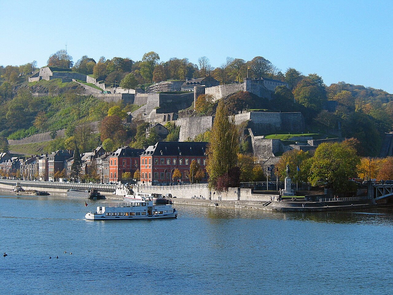
La Ciudadela de Namur (francés: Citadelle de Namur) es una fortaleza en la capital valona de Namur, en la confluencia de los ríos Sambre y Mosa. Data originalmente de la época romana, pero ha sido reconstruida en varias ocasiones. Su forma actual fue diseñada por Menno van Coehoorn, y mejorada por Vauban tras el sitio de 1692. Está clasificada como sitio de patrimonio mayor de Valonia. Su punto más alto se sitúa a 190 metros (620 pies). Junto con las de Dinant, Huy y Lieja, la Ciudadela de Namur forma parte de las llamadas Ciudadelas del Mosa.
La ciudadela original data del año 937. Alcanzó su extensión actual entre 1631 y 1675, cuando la ciudad estaba bajo control neerlandés. Esta sección se denominó «Terra Nova» para distinguirla del fuerte Médiane, más pequeño, construido junto a ella en 1542 y en los años siguientes. En el siglo XVIII se construyeron diversas posiciones auxiliares. Dejó de ser puesto militar en 1891, sustituida por un nuevo anillo de fuertes en torno a Namur, calculado para impedir que la ciudad pudiera ser atacada con artillería. Este anillo se convirtió en la Posición Fortificada de Namur en la década de 1930. La ciudadela se utilizó como espacio protegido para su puesto de mando.
Traducción automática de «Citadel of Namur» en la Wikipedia en inglés, CC BY-SA 4.0.
Citadel of Namur ocupa el puesto 1228 de 8134 en el mundo en la clasificación de fama de este atlas y el n.º 10 de los 92 que el atlas cartografía en Bélgica. Su fundación, en 937, es anterior a la del 94% de los monumentos datados del atlas — uno de los 138 monumentos del atlas fundados en el siglo X. Sus artículos de Wikipedia se abrieron 5605 veces en los últimos 60 días, más que el 86% del atlas. En 25 km a la redonda hay otros 9 monumentos del atlas. La guía de excursión más cercana es Namur, a 1 km. Compara el dato en las estadísticas de castillos.
Ver en el mapa interactivo de castillos →Preguntas frecuentes
¿Dónde está Citadel of Namur?
La fortaleza se encuentra en Bélgica, en las coordenadas 50.46056°, 4.86528°.
¿De qué año data Citadel of Namur?
El atlas fija su fundación en 937. Pudieron existir construcciones anteriores en el mismo lugar; este es el año documentado más antiguo.
¿Qué puesto ocupa Citadel of Namur en la clasificación por fama?
En la clasificación por fama de este atlas: n.º 1228 de 8134 en el mundo, y n.º 10 en Bélgica. La fama combina en cuántas ediciones de Wikipedia aparece un monumento y cuánta gente las lee.
¿Qué castillo está más cerca de Citadel of Namur?
Fortified Position of Namur, a unos 1 km.
Más castillos en Bélgica
- Ooidonk Castle Bélgica · siglo XVI
- Palacio de los Príncipes-Obispos de Lieja Bélgica · siglo X
- Fort de Tancrémont Bélgica · siglo XX
- Rumbeke Castle Bélgica
Más fortalezas
- Simatai China · siglo VI
- Puerta de Elvira España · siglo XI
- Torre de James Joyce Irlanda · siglo XIX
- Inchtuthil Escocia