 ベルギー · 10世紀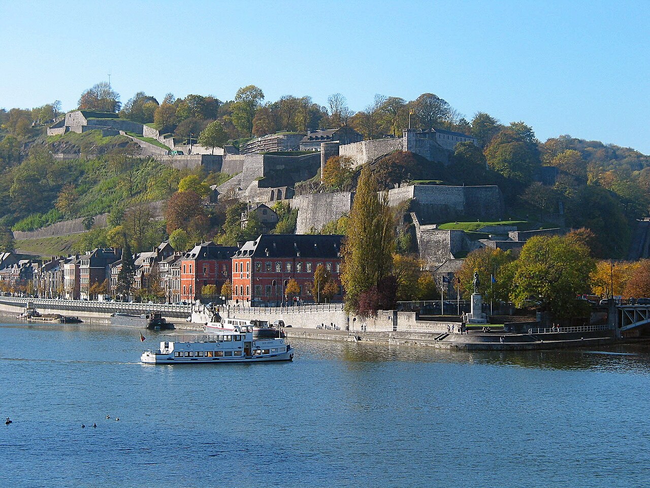
ナミュールのシタデル(フランス語:Citadelle de Namur)は、ワロンの首府ナミュール市、サンブル川とムーズ川の合流点にある要塞である。もともとはローマ時代のものだが、幾度も再建されている。現在の形はメンノ・ファン・クーホールンが設計し、1692年の包囲の後にヴォーバンが改良した。ワロニー主要遺産に分類されている。最高地点は標高190メートル(620フィート)にある。ディナン、ユイ、リエージュのものとともに、ナミュールのシタデルはいわゆるムーズのシタデル群の一部を成す。
元のシタデルは937年に遡る。1631年から1675年、市がオランダの支配下にあった時期に現在の広がりに達した。この部分は、1542年およびそれ以降に隣接して建てられたより小さなメディアーヌ砦と区別するため「テラ・ノヴァ」と呼ばれた。18世紀にはさまざまな補助的陣地が築かれた。1891年に軍事拠点としては廃止され、市が砲兵によって攻撃されるのを防ぐよう計算されたナミュール周囲の新しい砦の環に取って代わられた。この環は1930年代にナミュール要塞化陣地となった。シタデルはその司令部のための防護された空間として用いられた。
英語版ウィキペディア「Citadel of Namur」より機械翻訳、CC BY-SA 4.0。
ナミュール城は、アトラスの城の知名度ランキングで世界1,198位(全9,035件中)、ベルギーの128件では10位にランクされています。937年に創建され、アトラスの年代判明済みの城の94%より古い城です(10世紀に創建されたアトラス収録の192件のひとつ)。 Wikipediaの記事は直近60日で5,605回読まれ、アトラス収録の88%より多くの読者を集めています。半径25キロ以内にはアトラス収録の城が13件あります。最寄りの日帰りガイドは1キロ先のナミュールです。ベルギーが他とどう比べられるかは、城の統計をご覧ください。
インタラクティブ地図で見る →