Forteresse
Fort Pearson
🇿🇦 Afrique du Sud
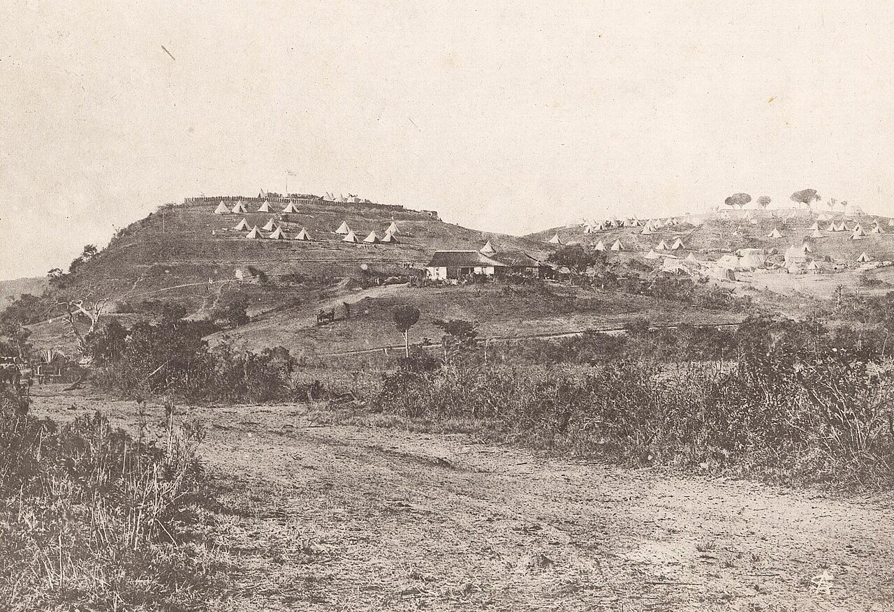
Fort Pearson était une fortification construite par les Britanniques du côté du Natal, à la frontière avec le Zoulouland, dans la période précédant la guerre anglo-zouloue de 1879. Redoute en terre bâtie sur une falaise de 300 pieds (100 m) de haut surplombant la rivière Tugela, le fort et ses deux redoutes extérieures commandaient un important point de passage de la rivière. Ce passage fut utilisé par l'une des colonnes de la première invasion de janvier 1879, qui fut ensuite assiégée à Eshowe, au Zoulouland. Le passage fut réutilisé par la colonne de secours d'Eshowe en mars, puis par la seconde invasion en avril. Le fort fut renforcé en avril 1879 et relié à Pietermaritzburg par télégraphe en juin. La guerre fut remportée par les Britanniques en juillet, mais le fort fut brièvement réoccupé par les troupes britanniques en 1883, lors de la troisième guerre civile zouloue.
Traduction automatique de « Fort Pearson » de la Wikipédia en anglais, CC BY-SA 4.0.
Fort Pearson occupe la 7 112e place sur 8 134 au classement de renommée de cet atlas et le 2e rang des 4 que l’atlas recense en Afrique du Sud. Voyez comment l’Afrique du Sud se compare dans les statistiques des châteaux.
Voir sur la carte interactive des châteaux →Questions fréquentes
Où se trouve Fort Pearson ?
Fort Pearson se trouve en Afrique du Sud, aux coordonnées -29.21372°, 31.43303°.
Quelle est la renommée de Fort Pearson ?
Au classement de renommée de cet atlas : 7 112e place sur 8 134 dans le monde, 2e place en Afrique du Sud. La renommée combine le nombre d’éditions de Wikipédia qui couvrent un monument et leur lectorat.
Quel château est le plus proche de Fort Pearson ?
La forteresse de Maputo, à environ 377 km.
D’autres châteaux en Afrique du Sud
- Fort Schanskop Afrique du Sud · XIXe siècle
- Fort Klapperkop Afrique du Sud · XIXe siècle
- Fort de Bonne-Espérance Afrique du Sud · XVIIe siècle
D’autres forteresses
- Mouse Fort Pays-Bas
- Fort of Santa Catalina Pérou · XIXe siècle
- Fort of Arrifana Portugal · XVIIe siècle
- Fort of São Miguel Arcanjo Portugal · XVIe siècle