Fortress
Fort Pearson
🇿🇦 South Africa
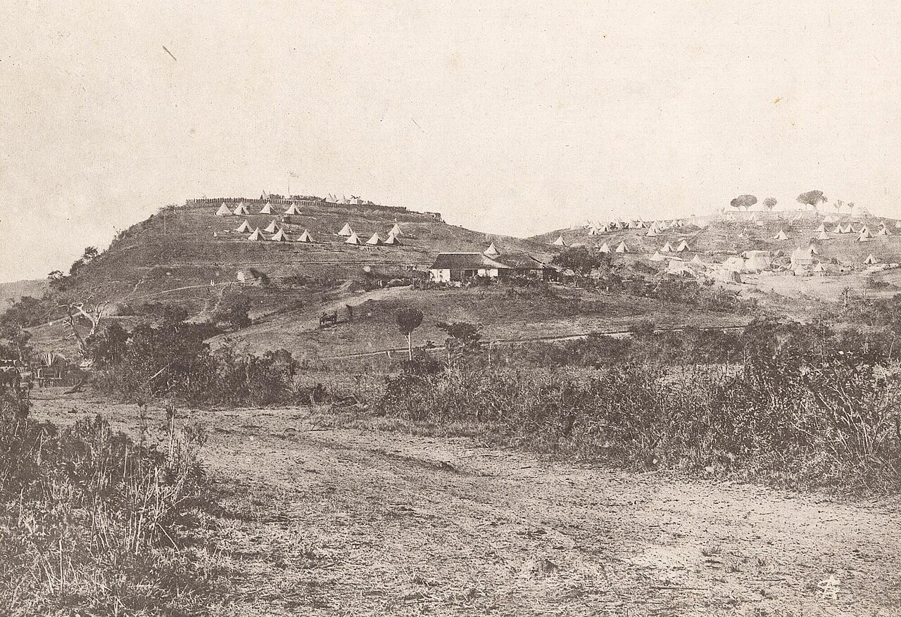
Fort Pearson was a fortification constructed by the British on the Natal side of the border with Zululand in the lead up to the 1879 Anglo-Zulu War. An earthen redoubt on a 300-foot (100 m) high cliff overlooking the Tugela River, the fort and its two external redoubts commanded an important river crossing. The crossing was used by one of the columns of the first invasion of January 1879, that was then besieged at Eshowe in Zululand. The crossing was used again by the Eshowe relief column in March and the second invasion in April. The fort was strengthened in April 1879 and connected to Pietermaritzburg by telegraph by June. The war was won by the British in July but the fort was briefly occupied again by British troops in 1883 during the Third Zulu Civil War.
Text adapted from “Fort Pearson” on Wikipedia, CC BY-SA 4.0.
Fort Pearson ranks #7,112 of 8,134 worldwide in the atlas's castle fame ranking, and #2 of the 4 mapped in South Africa. See how South Africa compares in the castle statistics.
View on the interactive castle map →Frequently asked questions
Where is Fort Pearson?
Fort Pearson stands in South Africa, at -29.21372°, 31.43303°.
How famous is Fort Pearson?
In this atlas's fame ranking: #7,112 of 8,134 worldwide, and #2 in South Africa. Fame here combines how many Wikipedia language editions cover a landmark with how many people read them.
What is the nearest castle to Fort Pearson?
Maputo Fortress, about 377 km away.
More castles in South Africa
- Fort Schanskop South Africa · 19th century
- Fort Klapperkop South Africa · 19th century
- Castle of Good Hope South Africa · 17th century
More fortresses
- Mouse Fort Netherlands
- Fort of Santa Catalina Peru · 19th century
- Fort of Arrifana Portugal · 17th century
- Fort of São Miguel Arcanjo Portugal · 16th century