Vesting
Fort Pearson
🇿🇦 Zuid-Afrika
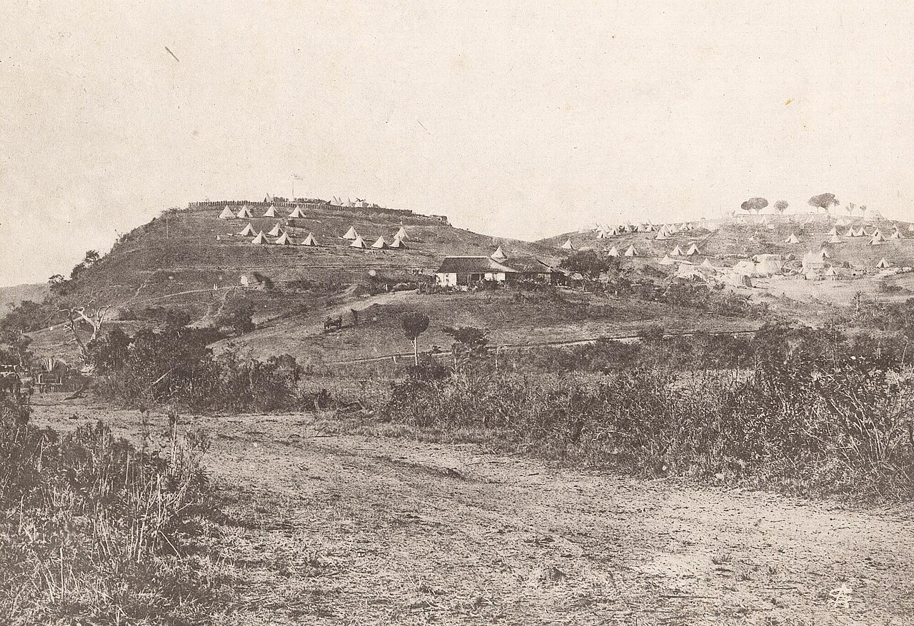
Fort Pearson was een vestingwerk dat door de Britten werd gebouwd aan de Natal-zijde van de grens met Zoeloeland, in aanloop naar de Anglo-Zoeloeoorlog van 1879. Het fort, een aarden redoute op een 300 voet (100 m) hoge klif boven de Tugela-rivier, beheerste samen met zijn twee buitenwerken een belangrijke rivieroversteek. Deze oversteek werd gebruikt door een van de colonnes van de eerste invasie van januari 1879, die vervolgens in Eshowe in Zoeloeland werd belegerd. De oversteek werd opnieuw gebruikt door de ontzettingscolonne naar Eshowe in maart en door de tweede invasie in april. Het fort werd in april 1879 versterkt en tegen juni via telegraaf verbonden met Pietermaritzburg. De oorlog werd in juli door de Britten gewonnen, maar het fort werd in 1883, tijdens de Derde Zoeloe-burgeroorlog, opnieuw kort door Britse troepen bezet.
Machinaal vertaald uit “Fort Pearson” op de Engelstalige Wikipedia, CC BY-SA 4.0.
Fort Pearson staat op plaats 7.112 van 8.134 in de bekendheidsranglijst van deze atlas en op plaats 2 van de 4 die de atlas in Zuid-Afrika in kaart brengt. Zie hoe dat zich verhoudt in de kastelenstatistiek.
Bekijk op de interactieve kastelenkaart →Veelgestelde vragen
Waar ligt Fort Pearson?
Fort Pearson ligt in Zuid-Afrika, op -29.21372°, 31.43303°.
Hoe bekend is Fort Pearson?
In de bekendheidsranglijst van deze atlas: plaats 7.112 van 8.134 wereldwijd, plaats 2 in Zuid-Afrika. Bekendheid combineert het aantal Wikipedia-taalversies met het aantal lezers.
Welk kasteel ligt het dichtst bij Fort Pearson?
Maputo Fortress, ongeveer 377 km verderop.
Meer kastelen in Zuid-Afrika
- Fort Schanskop Zuid-Afrika · 19e eeuw
- Fort Klapperkop Zuid-Afrika · 19e eeuw
- Kasteel de Goede Hoop Zuid-Afrika · 17e eeuw
Meer vestingen
- Muizenfort Nederland
- Fort of Santa Catalina Peru · 19e eeuw
- Fort of Arrifana Portugal · 17e eeuw
- Fort of São Miguel Arcanjo Portugal · 16e eeuw