Vesting
Fort Wint
🇵🇭 Filipijnen · 20e eeuw
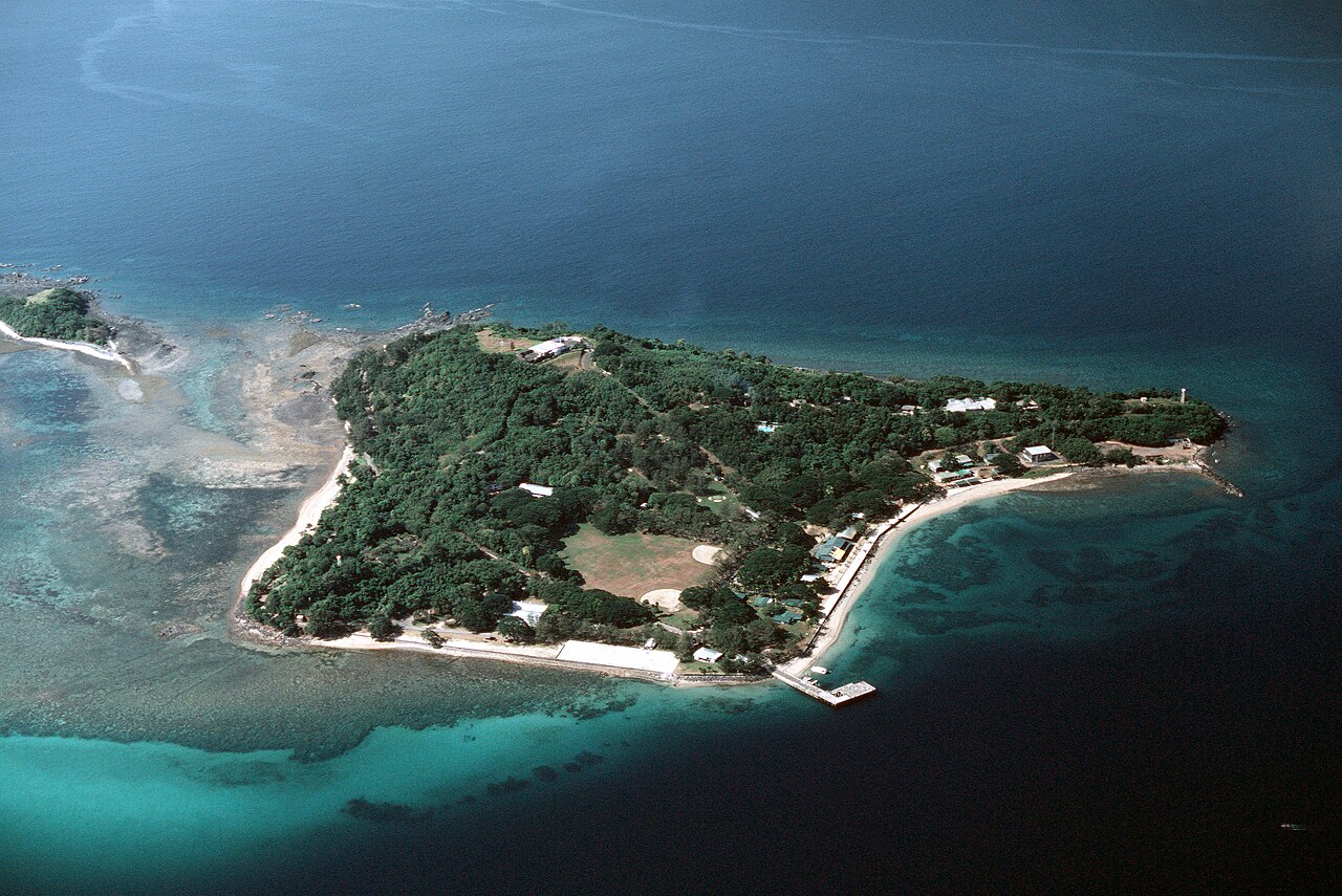
Fort Wint maakte deel uit van de havenverdediging van Manilla- en Subicbaai, gebouwd door het Philippine Department van het Amerikaanse leger tussen 1907 en 1920, naar aanleiding van aanbevelingen van het Taft Board, voorafgaand aan de niet-fortificatieclausule van het Vlootverdrag van Washington. Fort Wint lag op Grande Island bij de ingang van Subicbaai, ongeveer 35 mijl (56 km) ten noorden van Manillabaai. Het fort werd genoemd naar brigadegeneraal Theodore J. Wint. Zoals bepaald in de National Defense Act van 1935, was dit een van de locaties waar kustartillerietraining werd gegeven. Een batterij van het 60e kustartillerieregiment (luchtafweer) was hier gestationeerd.
Machinaal vertaald uit “Fort Wint” op de Engelstalige Wikipedia, CC BY-SA 4.0.
Fort Wint staat op plaats 6.629 van 8.134 in de bekendheidsranglijst van deze atlas en op plaats 7 van de 14 die de atlas op de Filipijnen in kaart brengt. Gebouwd in 1910 — een van de 169 bouwwerken in de atlas die uit de 20e eeuw stammen. Zie hoe dat zich verhoudt in de kastelenstatistiek.
Bekijk op de interactieve kastelenkaart →Veelgestelde vragen
Waar ligt Fort Wint?
Fort Wint ligt op de Filipijnen, op 14.76966°, 120.22786°.
Wanneer werd Fort Wint gebouwd?
De atlas dateert de stichting op 1910. Er kunnen eerdere bouwwerken hebben gestaan; dit is het oudste gedocumenteerde bouwjaar.
Hoe bekend is Fort Wint?
In de bekendheidsranglijst van deze atlas: plaats 6.629 van 8.134 wereldwijd, plaats 7 op de Filipijnen. Bekendheid combineert het aantal Wikipedia-taalversies met het aantal lezers.
Welk kasteel ligt het dichtst bij Fort Wint?
Fort San Felipe, ongeveer 80 km verderop.
Meer kastelen op de Filipijnen
- Fort Cuyo Filipijnen · 17e eeuw
- Fort of the Conception and of the Triumph Filipijnen · 18e eeuw
- Fort Pikit Filipijnen · 19e eeuw
- Fort Culion Filipijnen · 18e eeuw
Meer vestingen
- Fort Tabarka Tunesië · 16e eeuw
- Forte de Santa Bárbara da Vila Brazilië
- Forte de Santana do Estreito Brazilië · 18e eeuw
- El Mokrani Fort Algerije · 16e eeuw