 India
India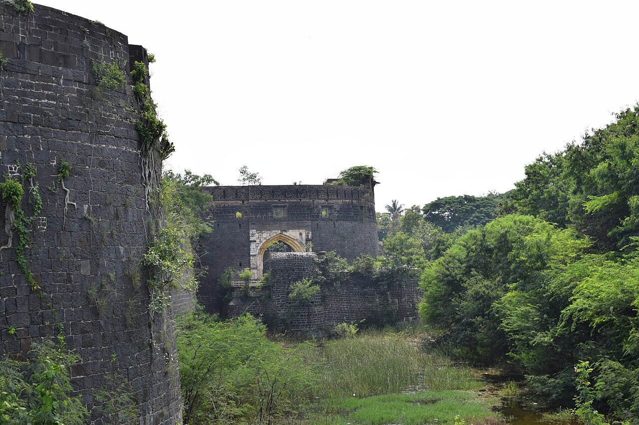
The Ahmednagar Fort (Ahmadnagar Qila) is located close to the Bhingar Nala near Ahmednagar in Maharashtra state western India. It was the headquarters of the Ahmednagar Sultanate. In 1803, it was taken by the British during the Second Anglo-Maratha War. It was used as a prison during the British Raj. Currently, the fort is under the administration of the Armoured Corps of the Indian Army.
In 1803, the Ahmednagar Fort was round in appearance, with twenty-four bastions, one large gate, and three small sally ports. It had a glacis, no covered way; a ditch, faced with stone on both sides, about 18 feet (5.5 m) wide, with 9 feet (2.7 m) water all around, which only reached within 6 or 7 feet (1.8 or 2.1 m) of the top of the scarp; long reeds grew in it all around. The berm was only about one yard wide. The rampart was of black hewn stone, and the parapet was of lime-plastered brick; both together appeared from the crest of the glacis to be only as high as the pole of a field-officer's tent. The bastions were all about 4.5 feet (1.4 m) feet higher; they were round. One of them had eight guns in a barbette mounting, pointing eastward; all the rest had jingals, four in each. In 1803 two guns were visible in each bastion, and 200 were said to be ready in the fort to be mounted.
A gunshot to the west of the fort was the Pettah of Ahmednagar. The main gate of the fort faced the pettah, and was defended by a small half-circular work, with one traverse and several little towers for men. There was a wooden bridge over the ditch, which could be taken away in time of war, but there was no drawbridge mechanism. It was reported that an iron trough as large as the bridge, could be placed upon it, or on the supporters of it, and filled with charcoal or other combustibles, which would then be set on fire as an enemy approached. The fort is also called as Bhuikot Killa which means it is a land fort and is not constructed on any hill. It should not be confused with other Bhuikot Killas in Maharashtra like Solapur Bhuikot Killa.
A small river came from the northward, round the west side of the pettah, and passed to the southward of the fort. A nullah (steep-sided valley) also passed from the northward, between the fort and a town called Bhingar, about a gunshot to the eastward, and joined the river.
Text adapted from “Ahmednagar Fort” on Wikipedia, CC BY-SA 4.0.
Ahmednagar Fort ranks #1,815 of 9,079 worldwide in the atlas's castle fame ranking, and #70 of the 224 mapped in India. Its Wikipedia articles were opened 2,673 times in the last 60 days, more than 75% of the atlas. The nearest day-trip guide is Junnar, 93 km away. See how India compares in the castle statistics.
View on the interactive castle map →