 Turkey · 12th century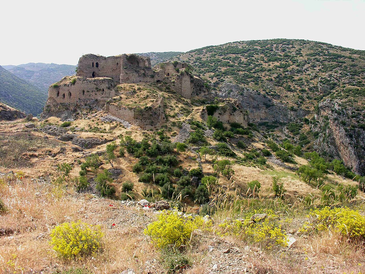
Bagras or Baghrās, ancient Pagrae (Greek: Πάγραι; Armenian: Պաղրաս, romanized: Paġras), is a ruined medieval castle in the İskenderun district of Turkey, in the Amanus Mountains.
Strabo’s Geographica describes Pagrae as a strong fortress in the district of Antioch, near Gindarus, situated on the pass over the Amanus Mountains that leads from the Gates of Amanus into Syria. It stood above the Plain of Antioch, through which the Arceuthus, Orontes, and Labotas rivers flowed.
Pliny the Elder lists Pagrae among the tetrarchies of Syria, together with Mammisea, Paradisus, and the Pinelitae, as part of the wider region of Cyrrhestice and the Syrian interior.
According to the Arab historian Al-Baladhuri, a massacre occurred in this place around the year 638 when 30,000 Ghassanid Arabs and their families were trying to escape the Muslim invasion of Syria but were attacked by the forces of Maisarah ibn Masruk, who had been sent in pursuit by Abu Ubaydah. This is likely exaggerated as many of these tribesmen would later serve in the Byzantine army.
Fortifications at Pagrae were erected in late 968 by the Byzantine emperor Nikephoros II Phokas, who stationed there 1000 footmen and 500 horsemen under the command of Michael Bourtzes to raid the countryside of the nearby city of Antioch. The castle provided a base for a force to cover the Syrian Gates, and was part of a multi-pronged approach by Phokas to inhibit communications between Antioch and the remaining Hamdanid emirate. It was built in two levels around a knoll, the fortification resembling Armenian work, and with water supplied by aqueducts. It is likely, that the Armenian monastic 'community of Jesus' (Yesuank‘/Yisuank‘) was located in the vicinity of the castle and was destroyed by the 1114 Marash earthquake.
It was then rebuilt about 1153 by the Knights Templar under the name Gaston (also Gastun, Guascon, Gastim) and held by them or by the Principality of Antioch until it was forced to capitulate to Saladin on 26 August 1189. It was retaken in 1191 by the Armenians (under Leo II), and their possession of it became a major point of contention between them and the Antiochenes and Templars. The castle remained under Armenian control until 1215, when it was taken back by the Templars who held the castle until the 1268 conquest of Antioch.
Text adapted from “Bagras” on Wikipedia, CC BY-SA 4.0.
Bagras ranks #1,586 of 9,079 worldwide in the atlas's castle fame ranking, and #35 of the 129 mapped in Turkey. Founded 1153, it is older than 80% of the atlas's dated landmarks — one of 756 atlas entries founded in the 12th century. Its Wikipedia articles were opened 1,990 times in the last 60 days, more than 69% of the atlas. 1 more atlas landmarks stand within 25 km. The nearest day-trip guide is Idlib, 66 km away. See how Turkey compares in the castle statistics.
View on the interactive castle map →