 Germany · 17th century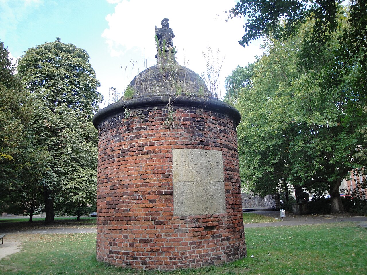
The Berlin Fortress (German "Festung Berlin") was the fortification of the historic city of Berlin. Construction started in 1650. The ramparts, walls, moats and glacis of the 17th-century bastion fort ran around the historic city limits. The demolition of its ramparts began in 1740.
Berlin was an important market place on the main east-west route (today Bundesstraße 1). However, it had no real fortifications, unlike Spandau in the west (Spandau Citadel) and Köpenick in the east (Köpenick Palace). Although Berlin was not the site of any battles during the Thirty Years' War (1618–1648) it suffered heavily from the Swedish occupation; by the end of the war in 1631, a third of the buildings had been demolished and half the population had fled or died.
Frederick William I, Elector of Brandenburg ordered the engineer architect Johann Gregor Memhardt to make plans for a fortification for the town. These began in 1650 following the contemporary fortification model of bastion forts in northern Italy. Large ramparts were erected and the space between was filled with water.
The construction of the parts east of the river was finished between 1658 and 1662. There were more problems with the western parts due to the swamps in the area and accordingly these were not finished until 1683. However, the ramparts on that side never reached their intended height.
While the Friedrichswerder, founded in 1662 and named after the Elector, was included in the fortifications, later city expansions were outside. Clearly visible on the city map from 1688 is the western peninsula of Dorotheenstadt (marked with E), an urban development project of the Elector's wife, Sophie Dorothea, which is barely fortified, except on the river bank, and separated from southern wasteland only by an artificial moat. The newly planted linden tree avenue, known as Unter den Linden, also runs through it.
The Elector died in 1688 and was succeeded by his son Frederick I. The new ruler expanded the city again and from 1691 created a third expansion, Friedrichstadt, south of Dorotheenstadt and west of Friedrichswerder (the latter marked C and D on the map of 1688), also built outside of the fortifications. Suburbs also developed in the north and east, more rampantly than planned.
Text adapted from “Berlin Fortress” on Wikipedia, CC BY-SA 4.0.
Berlin Fortress ranks #3,512 of 9,035 worldwide in the atlas's castle fame ranking, and #289 of the 709 mapped in Germany. Founded 1650, it is older than 25% of the atlas's dated landmarks, one of 708 atlas entries founded in the 17th century. Its Wikipedia articles were opened 1,645 times in the last 60 days, more than 64% of the atlas. 22 more atlas landmarks stand within 25 km. The nearest day-trip guide is Berlin, 1 km away. See how Germany compares in the castle statistics.
View on the interactive castle map →