 Northern Ireland · 12th century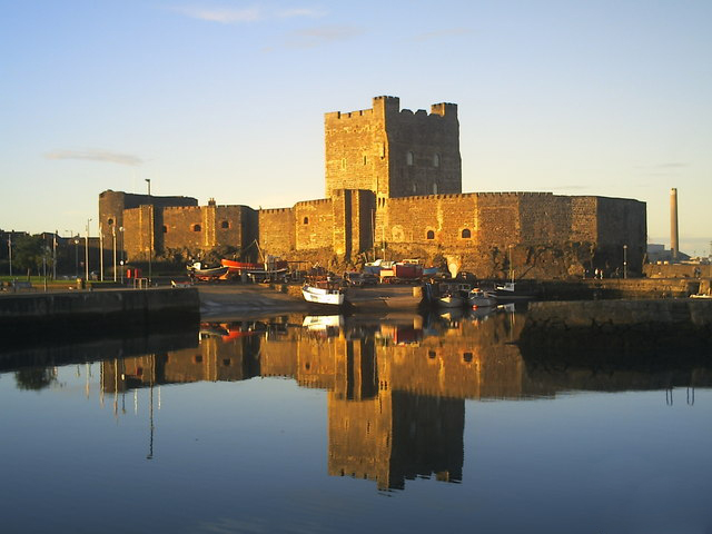
Carrickfergus Castle (from the Irish Carraig Ḟergus or "cairn of Fergus", the name "Fergus" meaning "strong man") is a Norman castle in Northern Ireland, situated in the town of Carrickfergus in County Antrim, on the northern shore of Belfast Lough. Besieged in turn by the Scottish, rebel Irish, English, and French, the castle played an important military role until 1928 and remains one of the best preserved medieval structures in Northern Ireland. It was strategically useful, with three-quarters of the castle perimeter surrounded by water (although in modern times only a third of it is surrounded by water due to land reclamation). Today it is maintained by the Department for Communities as a historic monument in state care.
Text adapted from “Carrickfergus Castle” on Wikipedia, CC BY-SA 4.0.
Carrickfergus Castle ranks #1,048 of 9,079 worldwide in the atlas's castle fame ranking, and #4 of the 39 mapped in Northern Ireland. Founded 1177, it is older than 78% of the atlas's dated landmarks — one of 756 atlas entries founded in the 12th century. Its Wikipedia articles were opened 4,437 times in the last 60 days, more than 85% of the atlas. 5 more atlas landmarks stand within 25 km. The nearest day-trip guide is Belfast, 15 km away. See how Northern Ireland compares in the castle statistics.
View on the interactive castle map →