Ruin
Châtel-Argent
🇮🇹 Italy · 12th century
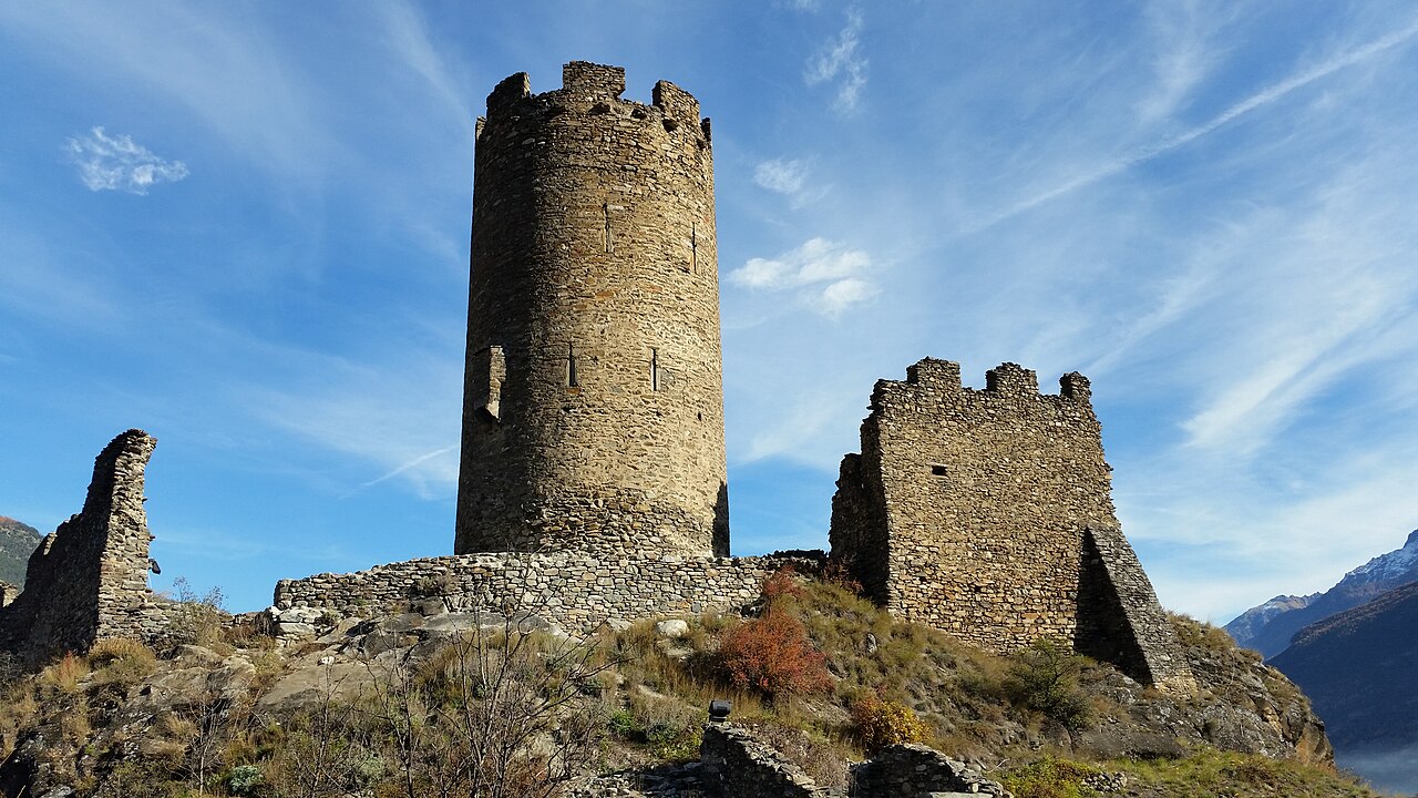
Châtel-Argent was an Italian medieval castle in the Alpine town of Villeneuve. It is now a ruin. As with many other castles in the region, Châtel-Argent overlooks the Dora Baltea (French: Doire baltée) River which runs through the Aosta Valley.
Originally the home of the Salassi people, settlements have existed on this site since prehistoric times and through the Roman Era. There is a chapel dedicated to Saint Columba of Sens which was built sometime between 1050 and 1070. The castle first appears in a document in 1176 as "Castrum Argenteum". The castle was improved around 1275 under the direction of Count Peter II's architect James St. George (French: Maître Jacques de Saint-Georges) and castle grew to the configuration we see today. This castle had always been owned by the counts and the dukes of Savoy.
The ruins can be accessed from Villeneuve by walking a staircase carved into the rock of the valley wall. The castle is located in the town of Villeneuve in the Aosta Valley region, at about 10 km west of the city of Aosta. The most prominent feature left in the ruins is its watchtower keep measuring just under 10 meters in diameter which overlooks the town below. The ruins themselves cover about 6,300 square meters. When the castle was whole, it was estimated to be able to hold 700 people in times of danger.
Text adapted from “Châtel-Argent” on Wikipedia, CC BY-SA 4.0.
Châtel-Argent ranks #5,670 of 8,134 worldwide in the atlas's castle fame ranking, and #419 of the 487 mapped in Italy. Founded 1176, it is older than 80% of the atlas's dated landmarks — one of 564 atlas entries founded in the 12th century. 7 more atlas landmarks stand within 25 km. The nearest day-trip guide is Turin, 78 km away. It is one of the 16 landmarks on the atlas's regional map of the Aosta Valley. It is stop 3 of 18 on the Aosta Valley castle route, Aosta to Ivrea. See how Italy compares in the castle statistics.
View on the interactive castle map →Frequently asked questions
Where is Châtel-Argent?
Châtel-Argent stands in Italy, at 45.70207°, 7.21123°.
When was Châtel-Argent built?
The atlas dates its founding to 1176. Earlier structures may have stood on the site; this is the earliest documented founding year.
How famous is Châtel-Argent?
In this atlas's fame ranking: #5,670 of 8,134 worldwide, and #419 in Italy. Fame here combines how many Wikipedia language editions cover a landmark with how many people read them.
What is the nearest castle to Châtel-Argent?
Sarriod de la Tour Castle, about 1 km away.
More castles in Italy
- Castello Sforzesco (Vigevano) Italy
- Castello del Catajo Italy · 16th century
- Conversano Castle Italy
- Castle of Gorizia Italy · 11th century
More ruins
- Hohenrechberg Castle Germany · 12th century
- Karaman Castle Turkey · 12th century
- Festenstein Castle Italy · 13th century
- Château de Dreistein France · 13th century