 Philippines · 18th century
Fort Culion ranks #8,952 of 9,040 worldwide in the atlas's castle fame ranking, and #13 of the 14 mapped in Philippines. Founded 1740, it is older than 18% of the atlas's dated landmarks, one of 685 atlas entries founded in the 18th century. See how Philippines compares in the castle statistics.
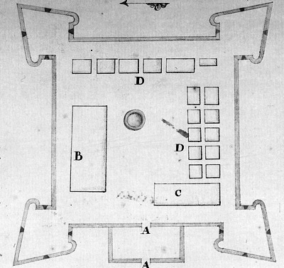
Fort Culion is a citadel built in 1740 during the Spanish-era in the Philippines. The Recollect Augustinians constructed the fort to defend themselves from Muslim invaders. The structure was built of stone, square-shaped, and with four bastions.
In 1930, the Jesuits used the coral stones used on the fort to build the walls of the Immaculate Conception Parish Church, also known as Culion Church. The fort, now in ruins, currently serves as a lighthouse. Its canons are still visible The National Historical Commission of the Philippines declared the fort as a historical landmark in 1939.
Text adapted from “Fort Culion” on Wikipedia, CC BY-SA 4.0.
View on the interactive castle map →