Fortress
Fort de Chartres
🇺🇸 United States · 18th century
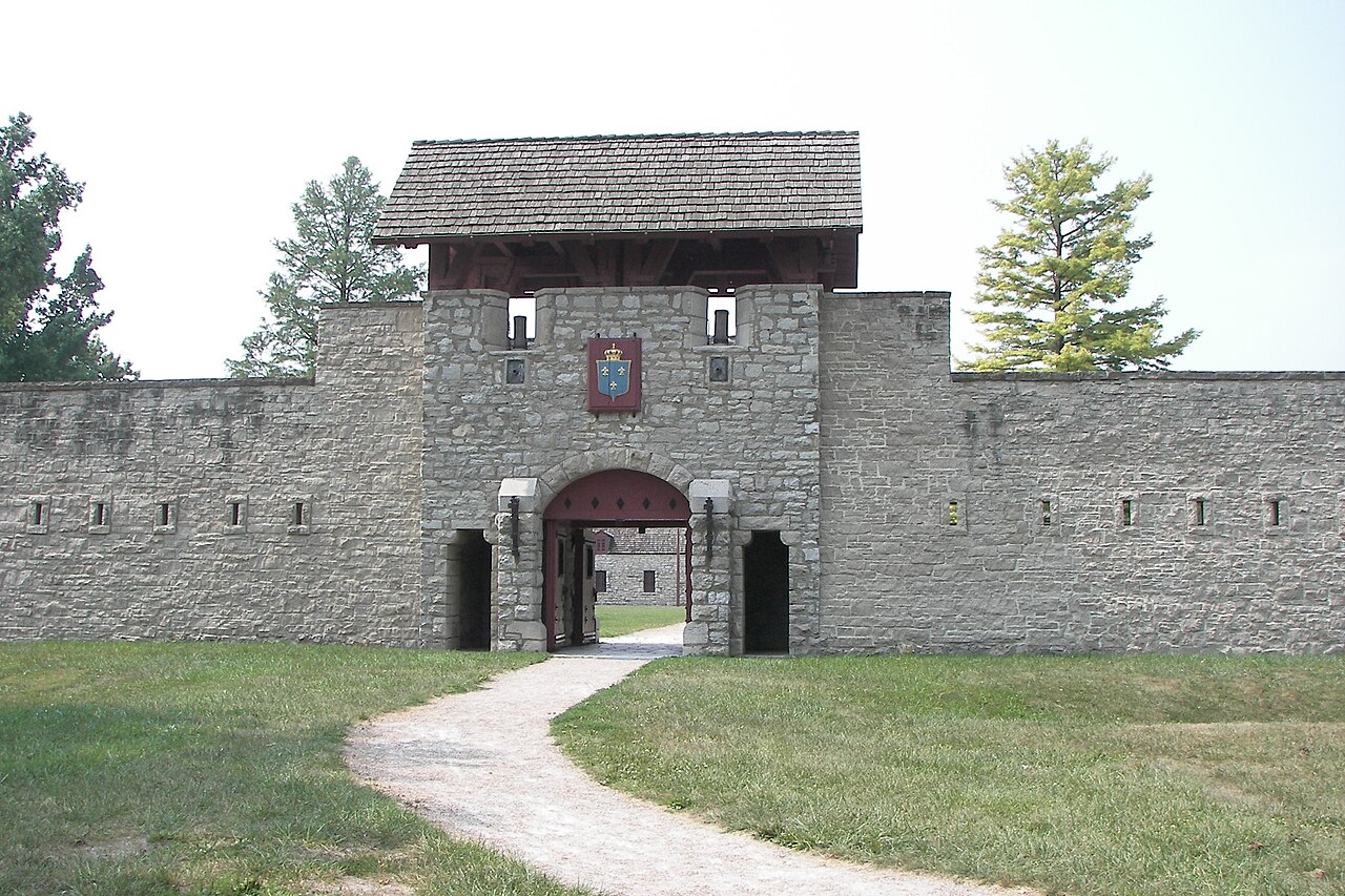
Fort de Chartres was a French fortification first built in 1720 on the east bank of the Mississippi River in present-day Illinois. It was used as the administrative center for the province, which was part of New France. Due generally to river flooding, the fort was rebuilt twice, the last time in limestone in the 1750s in the era of French colonial control over Louisiana and the Illinois Country.
The magazine (ammunition storehouse) of the fort is believed to be the oldest surviving building in Illinois. A partial reconstruction now exists of the limestone fort and the site is preserved as an Illinois state park, four miles (6 km) west of Prairie du Rocher in Randolph County, Illinois. Located on the floodplain area that became known as the American Bottom, the site is south of modern St. Louis. The forts were placed on the National Register of Historic Places and recognized as a National Historic Landmark on October 15, 1966. It was named one of the contributing properties to the French Colonial Historic District in 1974, along with other French-influenced sites such as the Creole House, the Pierre Menard House, the Kolmer Site (a former Indian village), and the site of Fort Kaskaskia.
The name of the fort honored Louis, duc de Chartres, son of the Regent of France. The state historic site today hosts several large re-enactments at the fort of colonial-era civil and military life each summer.
Text adapted from “Fort de Chartres” on Wikipedia, CC BY-SA 4.0.
Fort de Chartres ranks #4,525 of 8,764 worldwide in the atlas's castle fame ranking, and #85 of the 108 mapped in United States. Founded 1720, it is older than 21% of the atlas's dated landmarks — one of 638 atlas entries founded in the 18th century. Its Wikipedia articles were opened 2,445 times in the last 60 days, more than 73% of the atlas. See how United States compares in the castle statistics.
View on the interactive castle map →Frequently asked questions
Where is Fort de Chartres?
Fort de Chartres stands in the United States, at 38.08444°, -90.15778°.
When was Fort de Chartres built?
The atlas dates its founding to 1720. Earlier structures may have stood on the site; this is the earliest documented founding year.
How famous is Fort de Chartres?
In this atlas's fame ranking: #4,525 of 8,764 worldwide, and #85 in the United States. Fame here combines how many Wikipedia language editions cover a landmark with how many people read them.
What is the nearest castle to Fort de Chartres?
Fort Negley, about 369 km away.
More castles in the United States
- Hammond Castle United States · 20th century
- Fort Wayne, Detroit United States · 19th century
- Fort Delaware United States · 19th century
- Fort Vasquez United States · 19th century
More fortresses
- Fuerte San Miguel Uruguay · 18th century
- Santa Rosa de la Eminencia Castle Venezuela · 17th century
- Citadelle de Montmédy France · 16th century
- Bhujia Fort India · 18th century