Fortress
Fort Hays
🇺🇸 United States · 19th century
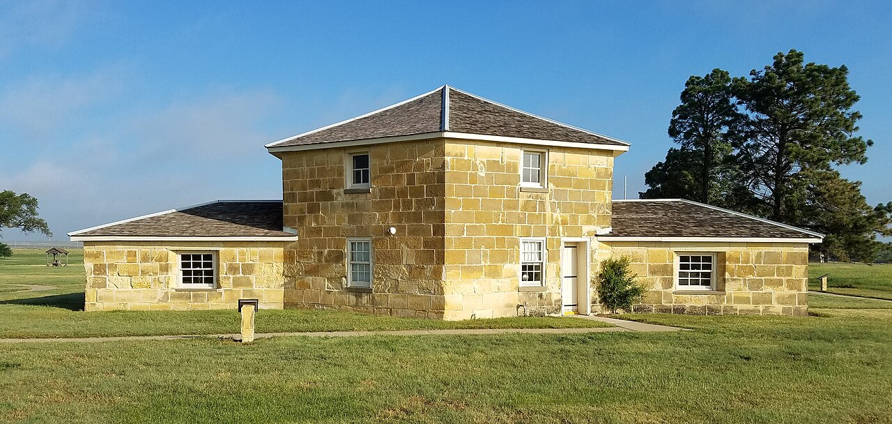
Fort Hays, originally named Fort Fletcher, was a United States Army fort near Hays, Kansas. Active from 1865 to 1889 it was an important frontier post during the American Indian Wars of the late 19th century. Reopened as a historical park in 1929, it is operated by the Kansas Historical Society as the Fort Hays State Historic Site.
To protect Butterfield Overland Despatch stage and freight wagons traveling the Smoky Hill Trail from Cheyenne and Arapaho attacks, the U.S. Army established Fort Fletcher on October 11, 1865. Named after then governor of Missouri Thomas C. Fletcher, the fort was located on the trail 1⁄4 mile (0.4 km) south of the confluence of Big Creek and the North Fork of Big Creek in western Kansas. Lt. Col. William Tamblyn and three companies of the 1st U.S. Volunteer Infantry established the post and were stationed there along with detachments of the 13th Missouri Cavalry. Raids on the stage line continued despite the military presence, and the line soon went bankrupt. Use of the trail ceased, and Fort Fletcher closed on May 5, 1866.
The U.S. Army reopened Fort Fletcher on October 11, 1866, at the confluence of Big Creek and its north fork, 1⁄4 mile north of the previous site. This time, the purpose of the fort was to protect workers building the Union Pacific Eastern Division railway westward, parallel to the Smoky Hill Trail. A month later, in November, the Army renamed the post Fort Hays after Brig. Gen. Alexander Hays who was killed at the Battle of the Wilderness during the American Civil War. On June 7, 1867, a severe flood nearly destroyed the fort, killing nine soldiers and civilians.
The Army planned to use Fort Hays as a supply depot for other posts in the region and thus needed it to be located close to the railway. But, the path of the railroad was five miles (8 km) to the north. Between that and the flood, the Army decided to relocate the fort. On orders from Maj. Gen. Winfield Hancock, Maj. Alfred Gibbs chose a new location 15 miles (24.1 km) to the northwest where the railway would cross Big Creek. The Army occupied this site, moving Fort Hays to its final location, on June 23, 1867. Attracted by the fort's new location and the railroad's westward extension, settlers soon arrived and established the communities of Rome and Hays City nearby, the latter named after the fort.
Text adapted from “Fort Hays” on Wikipedia, CC BY-SA 4.0.
Fort Hays ranks #3,299 of 8,134 worldwide in the atlas's castle fame ranking, and #63 of the 103 mapped in United States. Founded 1867, it is older than 7% of the atlas's dated landmarks — one of 607 atlas entries founded in the 19th century. Its Wikipedia articles were opened 3,624 times in the last 60 days, more than 79% of the atlas. See how United States compares in the castle statistics.
View on the interactive castle map →Frequently asked questions
Where is Fort Hays?
Fort Hays stands in the United States, at 38.8617°, -99.3422°.
When was Fort Hays built?
The atlas dates its founding to 1867. Earlier structures may have stood on the site; this is the earliest documented founding year.
How famous is Fort Hays?
In this atlas's fame ranking: #3,299 of 8,134 worldwide, and #63 in the United States. Fame here combines how many Wikipedia language editions cover a landmark with how many people read them.
What is the nearest castle to Fort Hays?
Fort Kearny, about 201 km away.
More castles in the United States
- Vieques Fort United States · 19th century
- Cove Fort United States · 19th century
- Fort Knox, Maine United States · 19th century
- Fort Wayne, Detroit United States · 19th century
More fortresses
- Fort Montagu The Bahamas · 18th century
- Tung Chung Battery China · 19th century
- Dalarö Fort Sweden · 17th century
- Tower of Llanes Spain · 13th century