Fortress
Fort Montbarey
🇫🇷 France · 18th century
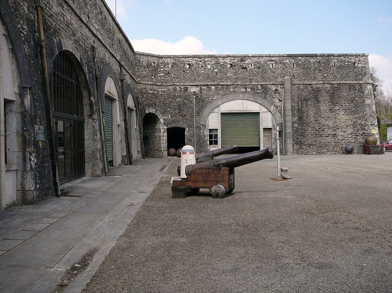
The Fort Montbarey is a fortified stronghold, built between 1777 and 1784, to the west of Brest. The fort is similar to the related Questel Fort.
This stronghold, built because Louis XVI wanted to make Brest impregnable, was the most important link in the defense of the city's west side, designed for 500-600 soldiers.
This fort was used by the Germans in 1944, who installed a parachute battalion during the siege of Brest by the Americans. After many assaults and heavy use of tanks and flamethrowers, the garrison surrendered on 16 September 1944.
Rebuilt after World War II, during the Cold War Fort Montbarey hosted the DCA (Defense Against Aircraft) command center of the port of Brest and had in its yard two large bunkers. It also had, at this time, a search radar for aircraft. These facilities were decommissioned in the late 1960s.
In 1984 Fort Montbarey was developed by the Navy into a museum on the history of Finistère during the Second World War, featuring the Resistance effort. An exhibition on "Brest in ruins" is also presented, as well as a "wagon of death" used in the Holocaust and many American vehicles and parts from the DCA (Defence Against Aviation) era, and a British Churchill tank. The museum also manages over 10,000 files and documents on the Resistance, and records on soldiers and victims of the Second World War. It annually hosts more than 10,000 visitors.
The fort is one of a series of strongholds that surround Brest, including Questel Fort.
Visiting a stronghold of Louis XVI Gallery 10000 Finistère died for France Tribute to fallen World War Allies Photos of Brest in ruins Films about Brest at war The wagon used in the deportation of Jews during the Holocaust. Military vehicles classic Various materials of the war 39/45 Exhibitions Models of battle scenes
Text adapted from “Fort Montbarey” on Wikipedia, CC BY-SA 4.0.
Fort Montbarey ranks #6,384 of 8,764 worldwide in the atlas's castle fame ranking, and #546 of the 675 mapped in France. Founded 1777, it is older than 15% of the atlas's dated landmarks — one of 638 atlas entries founded in the 18th century. 7 more atlas landmarks stand within 25 km. The nearest day-trip guide is Brest (France), 5 km away. See how France compares in the castle statistics.
View on the interactive castle map →Frequently asked questions
Where is Fort Montbarey?
Fort Montbarey stands in France, at 48.37822°, -4.54836°.
When was Fort Montbarey built?
The atlas dates its founding to 1777. Earlier structures may have stood on the site; this is the earliest documented founding year.
How famous is Fort Montbarey?
In this atlas's fame ranking: #6,384 of 8,764 worldwide, and #546 in France. Fame here combines how many Wikipedia language editions cover a landmark with how many people read them.
What is the nearest castle to Fort Montbarey?
Questel Fort, about 3 km away.
More castles in France
- Fort Napoléon des Saintes France · 18th century
- Fort Queyras France · 13th century
- Fort Rapp France · 19th century
- Fort Saint Louis (Martinique) France
More fortresses
- Fort de Cormeilles France · 19th century
- Fort de l'Îlette de Kermorvan France · 19th century
- Fort de la Pompelle France · 19th century
- Fort des Têtes France · 18th century